
As I mentioned in earlier posts, to travel in Ethiopia at the time we were there was very difficult. To the long distances to be travelled, the war situation demanded the “infamous” travel permits that were not easy to obtain. It was for these reasons that our plans to visit Axum and Lalibela as well as the Omo valley were not viable.
We did manage some travel although more restricted and this is what I will describe in this post. I present you with brief descriptions of the various trips we did.
Around Addis
Apart from exploring the city itself, we visited a few churches such as the Entoto Maryam and the Kiddus Raguel, two of the best known.
We found the Entoto Mariam (Mary’s) church in the northern part of Addis, in one of the highest hills around the city. The area was still well forested and densely populated and we could see lots of people walking about as well as the ubiquitous pack donkeys moving teff straw to feed their domestic animals.
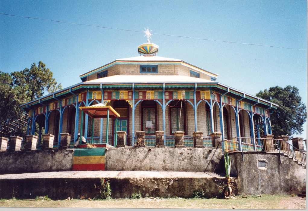
The church was built in 1877 by Emperor Menelik II. His wife (Empress Taitu) is buried there and the tomb is known as “Shera Bet”. Eucaliptus trees are quite common in the highlands of Ethiopia and it was near this church that the first one was planted!
There is a museum right next to the church where some of the personal belongings of Emperor Menelik II and Empress Taitu are displayed for visitors to see. Some of the historical items include traditional clothes, crowns of Emperor Menelik II and Empress Taitu, their royal bed, different jewels owned by the royal family, and a mirror presented as a gift from Queen Victoria to Empress Taitu.
We visited the octagonal church on a Sunday but refrained from entering it or visiting the spring that produces “holy water” nearby where sick people go to get cured with the assistance of the church’s priests for respect to the believers present there. Unfortunately, the museum was closed. We walked about the church grounds and caught sight of the remains of Menelik’s palace that looked rather unimpressive!
Although we inspected the various eucalyptus trees present around the church none, in our judgement, could have been the first one. This tree was brought directly from Australia and planted there. Another interesting item we missed!
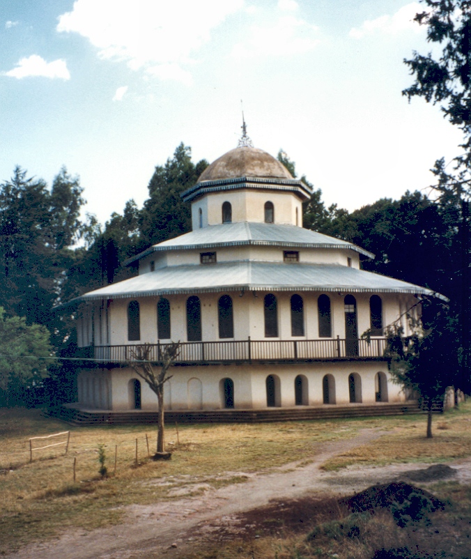
After enjoying the view of the city below we continued our tour and went to another church, the Kiddus Raguel, also well known and it too found on the Entoto Hills about 2.5 km away. This church is the oldest church in Addis, also built by Emperor Menelik II, who also founded Addis Ababa, about 140 years ago. This church, unlike the octagonal style of the previous one, is hexagonal, the same as many other Orthodox churches found in Ethiopia.
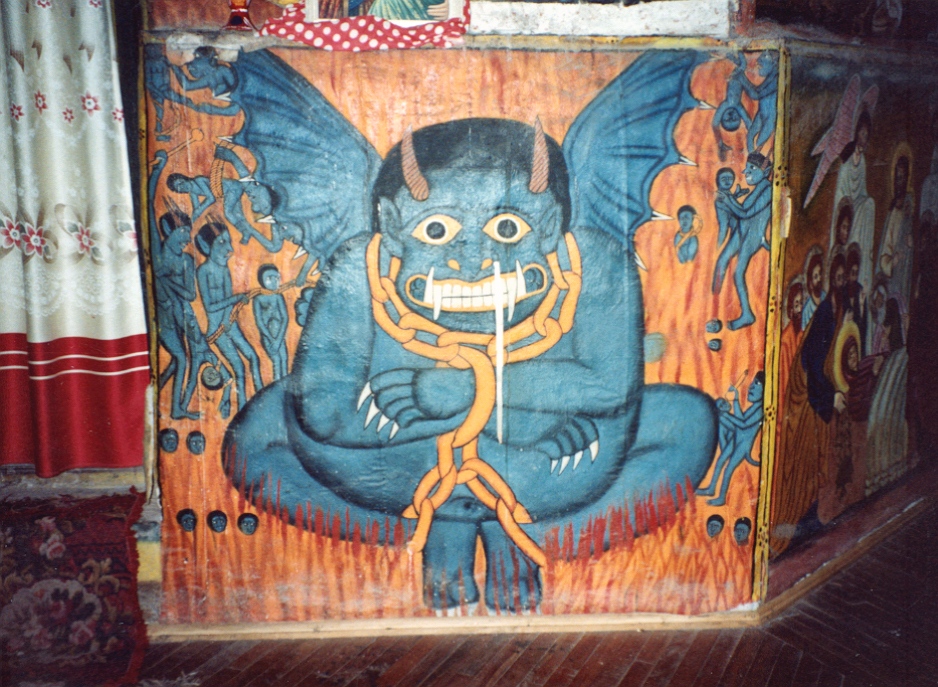
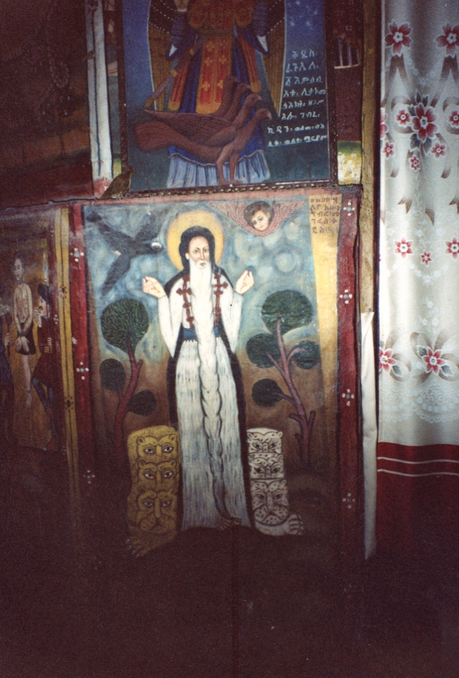
We were able to enter the building as, by the time we got there, mass had ended. There, the inner part of the church,where mass is celebrated was secluded by curtains and a few panels decorated with well preserved hand paintings that were centuries old.
The Nile Gorge
The Abbay River originates in Lake Tana, about 500 km and a ten hour drive (today) to the northwest of Addis. The river runs through Ethiopia and it becomes known as the Blue Nile when it enters Sudan on its way to join the White Nile -coming from Lake Victoria- north from Khartoum area. These two are the major contributors to the Nile River that ends in the Mediterranean Sea in Egypt and, interestingly, both originates in lakes.
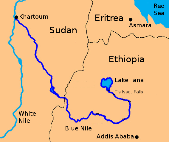
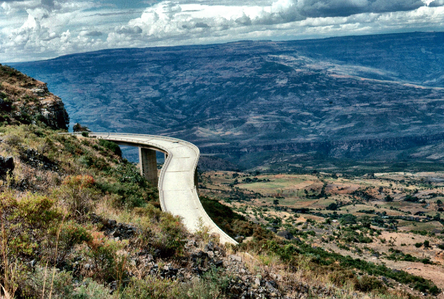
As mentioned earlier, travel restrictions did not allow us to visit Bahir Dar, the city located at the southern tip of Lake Tana but, as a consolation, we could see the Nile river at an area known as the Nile Gorge.To get there we took the road to Bahar Dar road and drove for over two hundred kilometres through the highlands (over the Entoto mountain range). At about two hundred kilometres the scenery opens up and you have a most magnificent view of the river that, shining blue, runs about one thousand metres below!
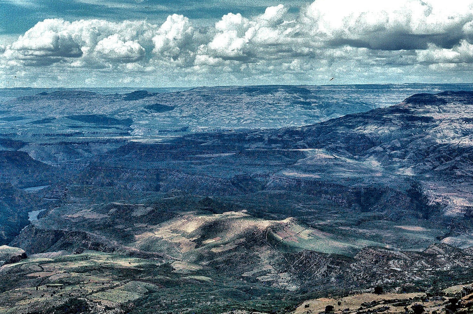
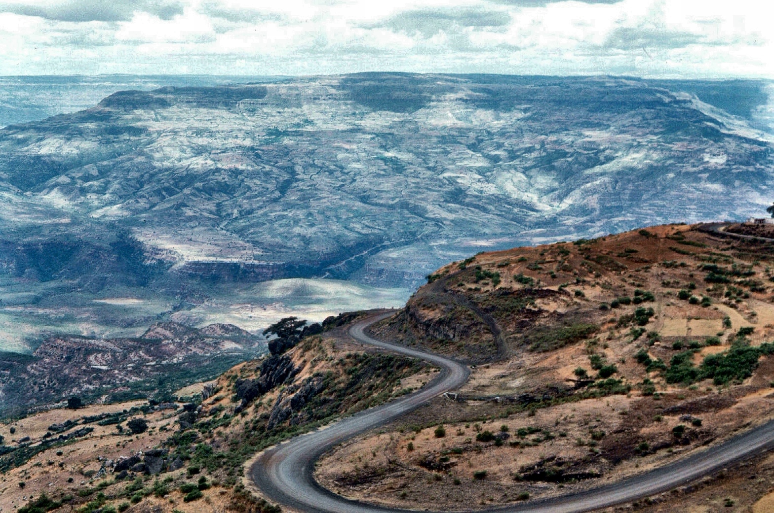
Over millions of years the river has carved this deep and wide valley through the mountains that many people compare (as usual!) with America’s Grand Canyon. Although I have not been in the latter, what we saw was a truly vast canyon that run for as long as the eye could see and through which, for the first time in our lives we could spot the amazing bearded vultures, also known as lammergeiers (Gypaetus barbatus).
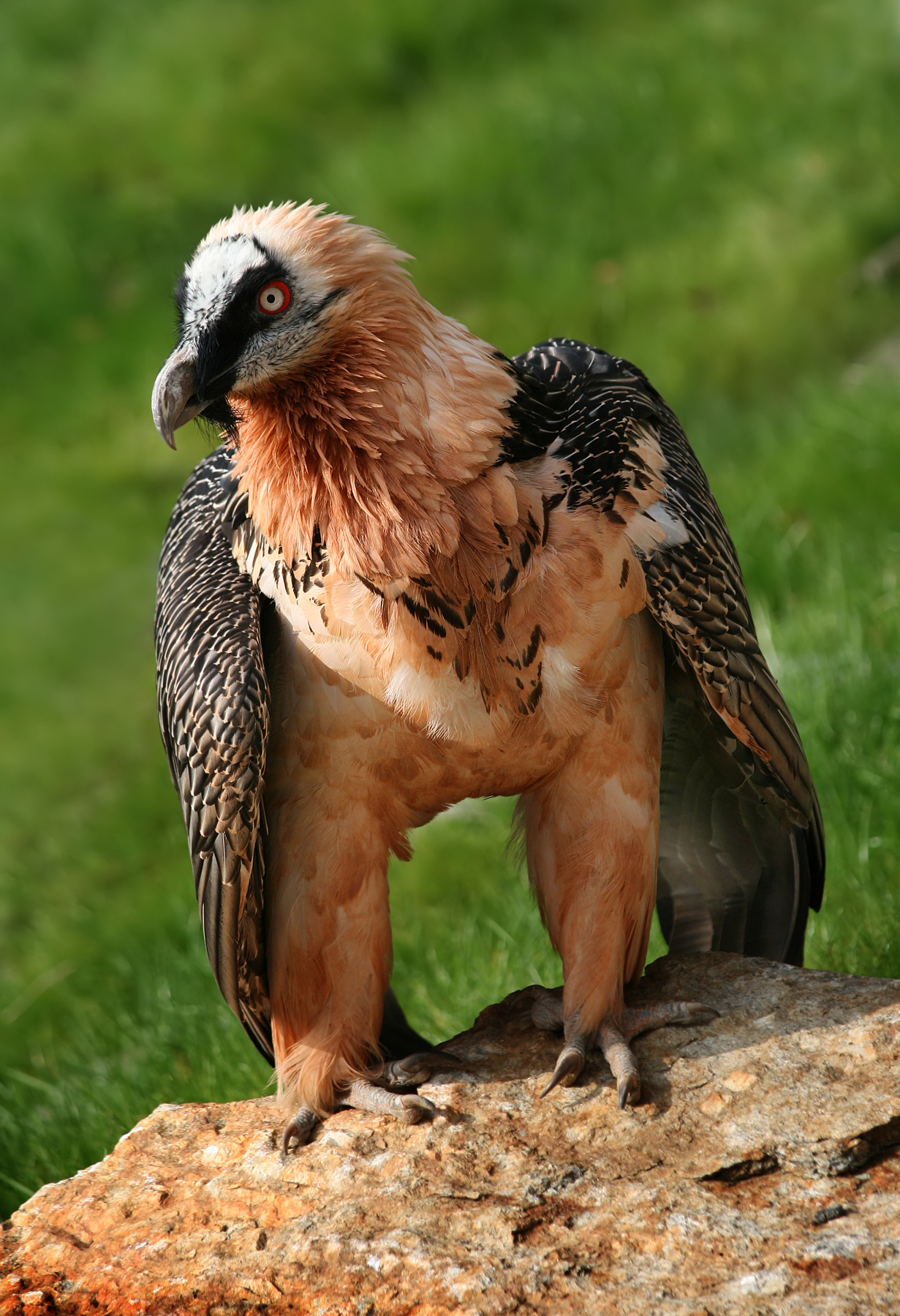
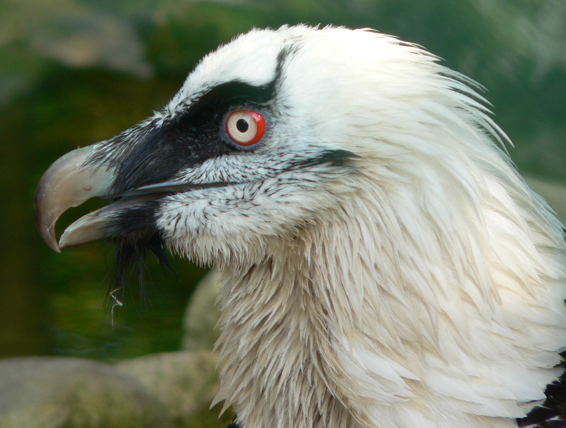
We watched the birds for a long while as they caught the thermals to climb high above us as we had seen vultures do very often. However, the gorge also allowed us to see them glide below us while they gained altitude and then climbed quite close to us on their way to great hights. A truly magnificent sight.
Spotting the lammergeiers was almost as amazing as spotting a stretch of road ahead of us that luckily we did not take! It was a true road to nowhere, part of an attempt at climbing the mountains gone wrong that ended abruptlly, allowing you to take the jump to the bottom of the gorge! I am not sure what happened there but I took a picture to prove it.
The Ethiopian Rift valley
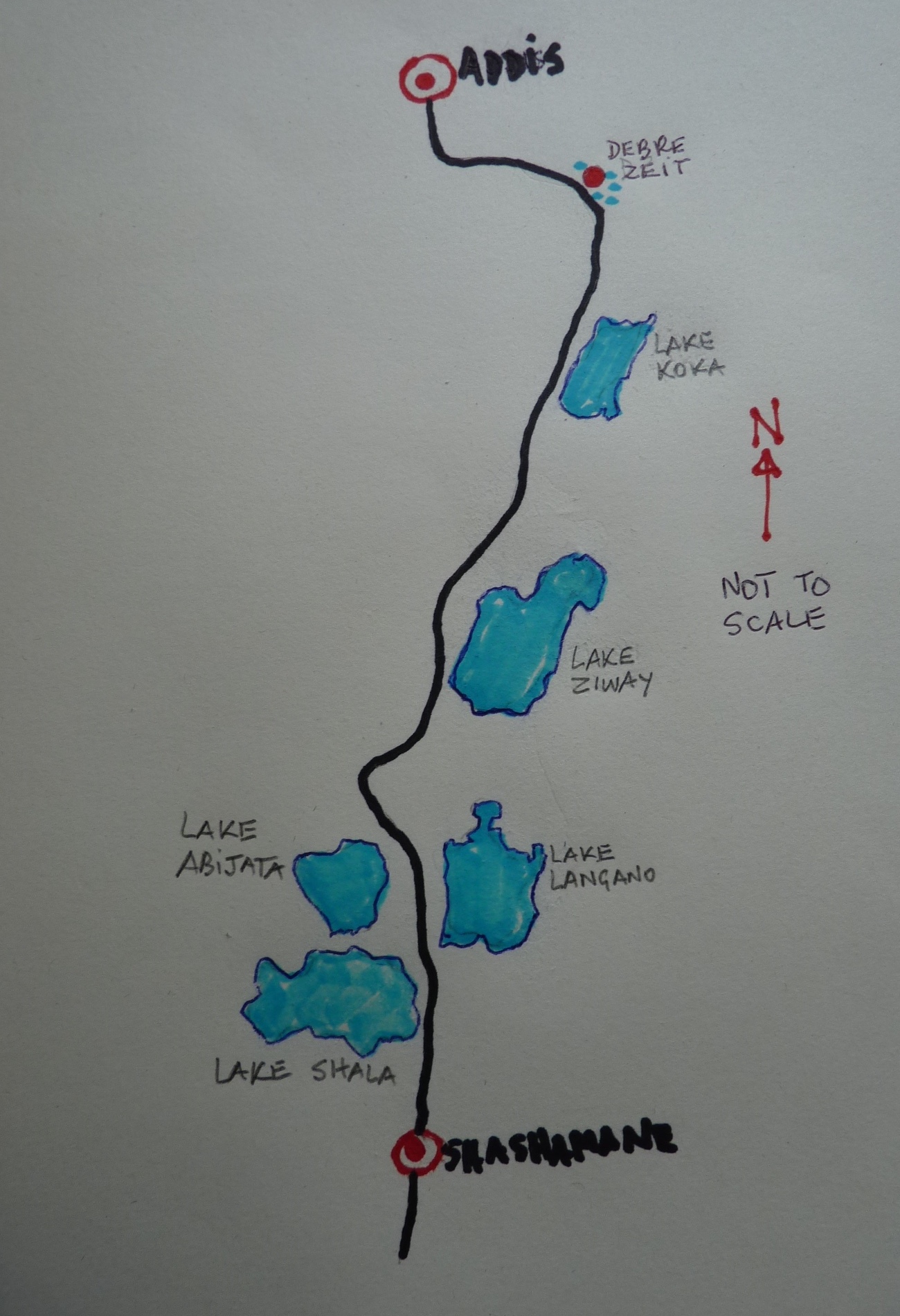
From Addis to Debre Zeit (Bishoftu in Oromo) was 47 km following the A1 road. It was a very popular recreation for day trips or weekend escapades from Addis at it offered warmer climate by being lower (1900 m). It was surrounded by several small lakes of volcanic origin such as Bishoftu, Babogaya, Hora, Magarsa and Kuriftu where some hotels offered decent accommodation. The Veterinary Research Laboratory was located there as well as a field station belonging to the then International Livestock Centre for Africa. The latter sited at lake Babogaya, green and volcanic.
Debre Zeit still had trees -a rare sight in Addis- as well as many interesting water birds and from there we could continue driving south and then take the A7 that took us to a number of interesting larger lakes located in the Rift valley. As you drove you would first come to the 180 km2 Koka reservoir (also known as lake Gelila) that was in fact product of a dam built on the Awash river. From then on, a string of lakes that reminded us of those in Kenya, followed.
The freshwater lake Zway or Lake Ziway (Oromo: Lake Dambal) came first at just over 100 km south of Debre Zeit. The lake is fed primarily by the rivers Meki and Katar, and is drained by the Bulbar river which, in turn, enters lake Abijata further south. It is believed that the Ark of the Covenant was housed at a monastery on its shores during the 9th. century. Although we did not find the monastery, we had a good time watching birds such as pelicans and the numerous hippos that inhabited the lake. It has an estimated area of 440 km2 and 30 km long (three times lake Naivasha in Kenya).
Further south there were lakes on both sides of the road: Langano on the left and Abijata and Shala on the right. The latter was alkaline and covered 205 km2 and a maximum depth of 14 m. Like Magadi in Kenya it hosted a soda ash operation in its shores (the same as in Shala and Chitu lakes nearby). We saw lots of flamingoes there but nothing in the level of Nakuru or Bogoria further south, in Kenya.
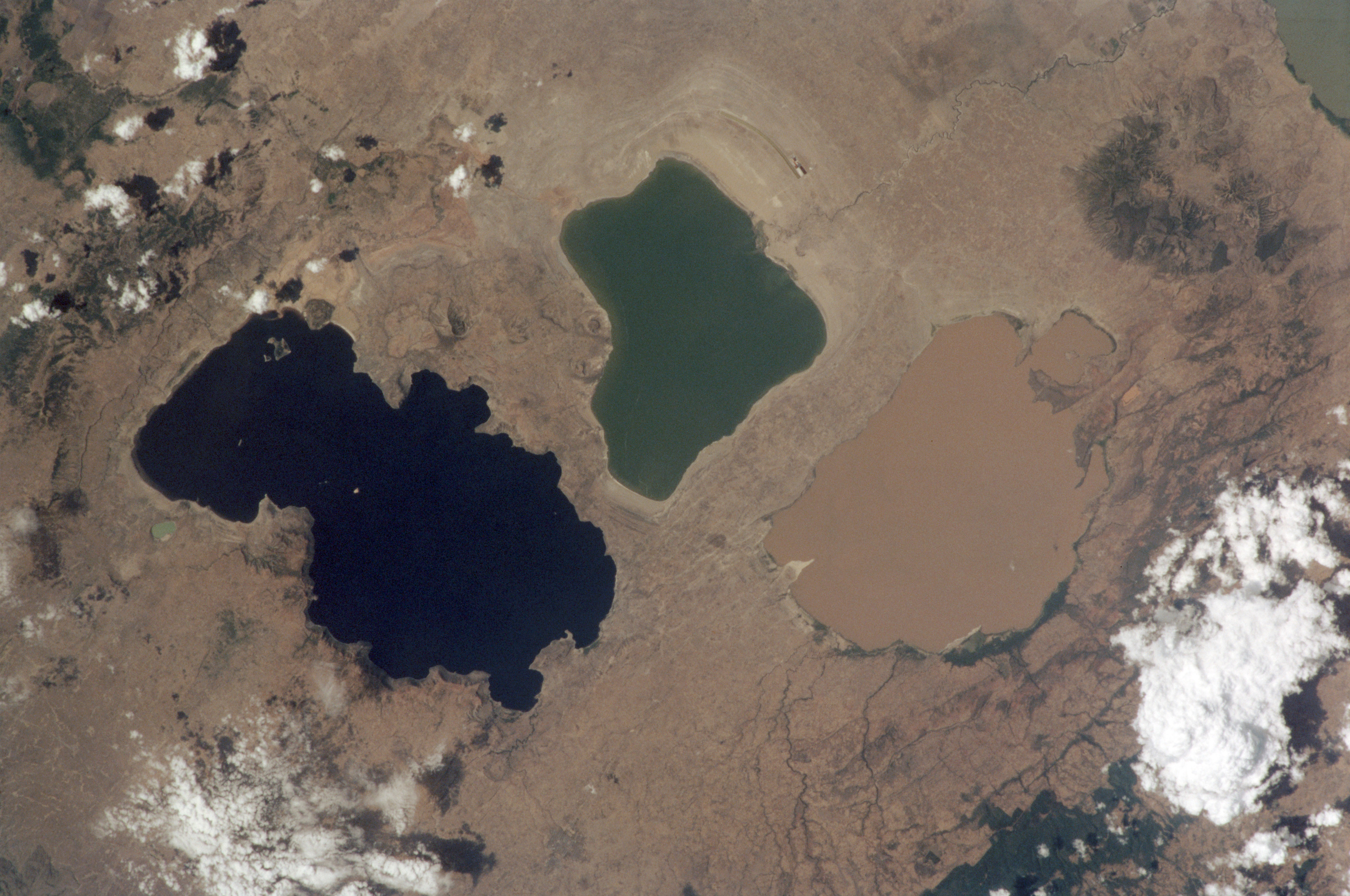
Lake Langano, located to the east of Lake Abijata at an elevation of 1,585 m is of similar size but filled with fresh water to a maximum depth of 46 m that it catches from a basing as large as 1600 km2. It is drained by the Hora Kallo river which empties into Lake Abijatta. Lake Langano is the only freshwater lake in Ethiopia free from Bilharzia (Schistosomiasis) and therefore a popular venue with tourists and city-dwellers that ignore the possible crocodiles!
Although fresh, its water is not clean looking but rather brown because of the high mineral content that many believe gives its waters healing properties. As expected, there were a few resorts around the lake that had increased in number today and from where water sports were practiced. Some wildlife was present there including hippos -not seen often-, monkeys and warthogs and numerous water bird species.
On one occasion, while walking along the shore we saw that the waves broke through water full of flotsam. As we had not seen this in a lake before, we came close for a better look that revealed that, in fact, they were pumice stones, very much like the ones we buy in the chemist to rub our heels with! Of course we collected a few that we still keep. When writing this piece I learnt that pumice is created when very hot rock is violently ejected from a volcano under intense pression and the foamy structure of pumice takes place because of concurrent rapid cooling and loss of pressure. It is infact volcano solidified foam!
An unexpected find in the journey to the visit the Langano-Abijata-Shala lakes were the crocodiles. These were not seen basking at the shores of the lakes or swimming but crushed on the road while trying to move between lakes! It was a real road hazard as some of them were really large and occupied the whole width of the road!
Shala lake, with a surface area of 329 km2 is the deepest of Ethiopia’s Rift Valley lakes reaching 266 m. It is surrounded by sulphur hot springs boiling away and smelling like rotten eggs. The land around the lake is criss-crossed with cracks due to erosion and earthquakes. Pelican island in the south host a colony of the beautiful great white pelicans and other birds such as lesser and greater flamingoes.
More lakes are found further south and east of the Bale mountains. These are Awassa, Abaya and Chamo and, further south lakes Stefanie and the Jade sea, lake Turkana. We never reach these lakes but stopped at Shashamene Zuria, an interesting place as you will see.
Shashamane Zuria [1]
Driving towards the lakes we were quite surprised to find Rastafarian-looking people walking towards the South. Then we learnt that their goal was a place called Shashamane that, for some reason was the Mecca for these people. We decided to pay the town -located 22 km from the southern tip of lake Shala- a visit.
We did not find the town anything special, apart from the community of Rastafarians that resided there as it was regarded as a “patch of Jamaica” in Ethiopia. It was more an issue of learning its history.
In the 1950s the then Emperor Haile Selassie I donated about 200 hectares to African Americans who were victims of racism and injustice after being exiled and forced into slavery in the USA. Jamaicans learnt about this and they a started coming so the Rasta movement started. The name Rastafarian derives from “Ras Tafari Makonnen”, the title of Haile Selassie I before he became Emperor and the latter still plays a major role in the Rasta culture [2]. The red, green and yellow colours of the movement are those of the Ethiopian flag.
Gladstone Robinson was the first Rastafarian to settle in Shashamane in 1964 and when we were there, there were a few hundreds residing there although their land had been reduced to just over 10 hectares by the Mengistu’s regime. It was an interesting visit that increased our knowledge of the Rastafarian movement.
Awash National Park
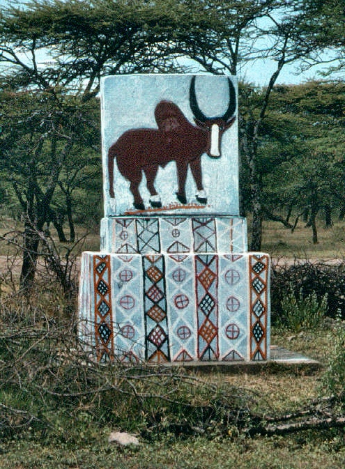
A couple of times we headed towards the East of Addis in search of the Awash National Park, located in the southern part of the Afar region of Ethiopia. At 225 km from Addis the park was quite easy to reach and enabled us to visit it over the weekends.

Much further North is the Danakil depression, famous for being 100 m below sea level, one of the lowest and hottest places on earth. The Danakil area was explored by Wilfred Thesiger that wrote some very interesting books about his esploits there [3]. Unfortunately, this interesting area was out of reach at the time so we could not visit it and remains one of the places I would love to see.
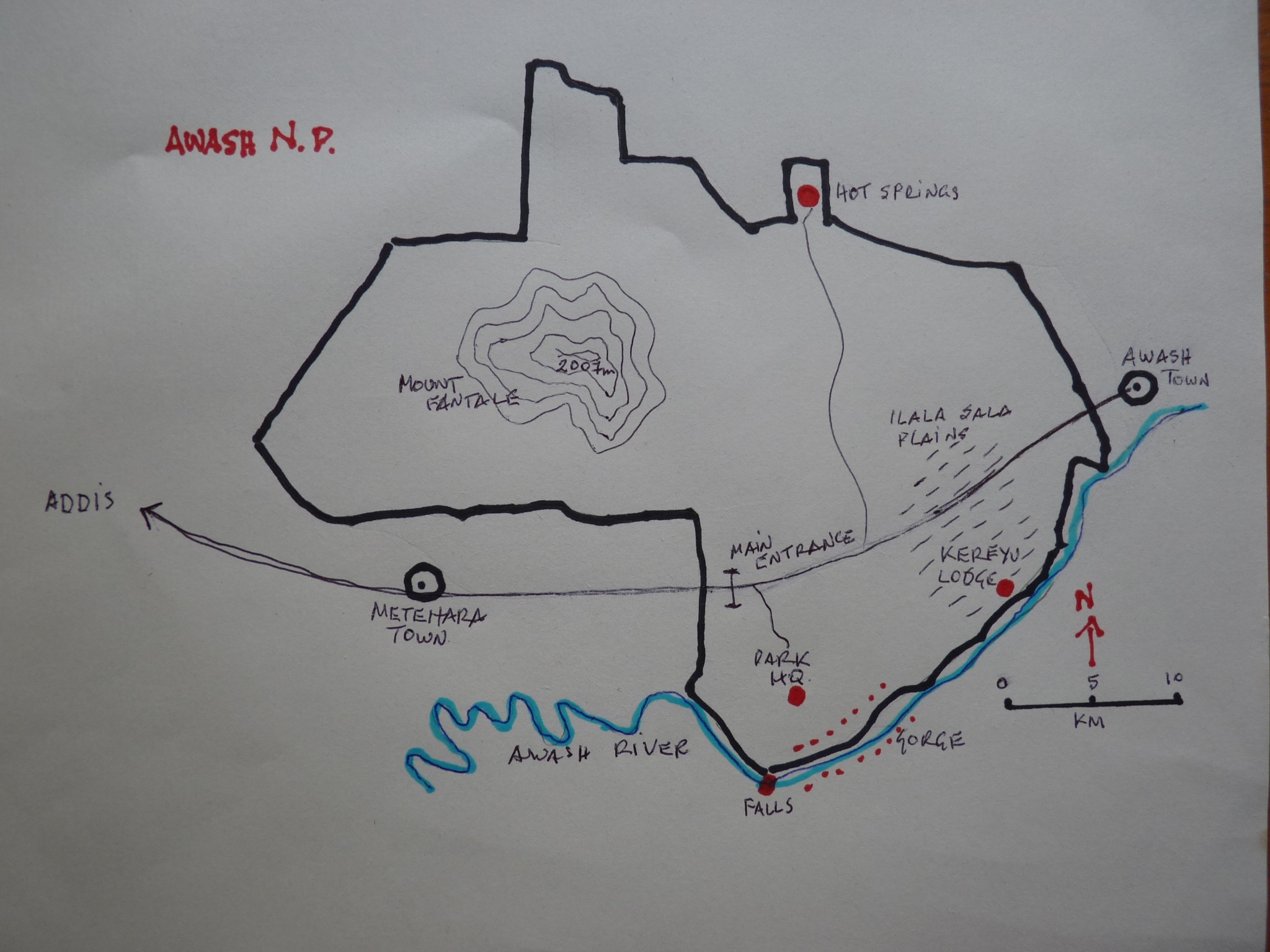
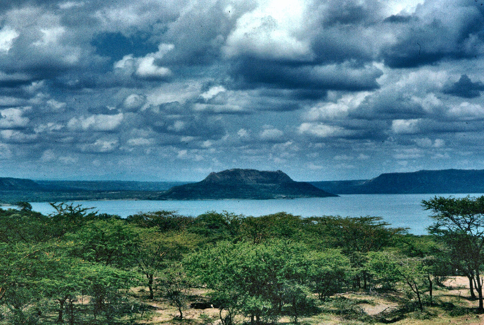
The park, set up in 1966, is at the southern tip of the Afar Region and it has an area of about 800 km2 and an average altitude of 900 m. The south boundary of the park is formed by the Awash river which swings North soon after leaving the park and eventually disappears into the Afar (Danakil) region. In the middle of the park is the dormant Fantale, a dormant volcano reaching a height of 2007 m at its top.
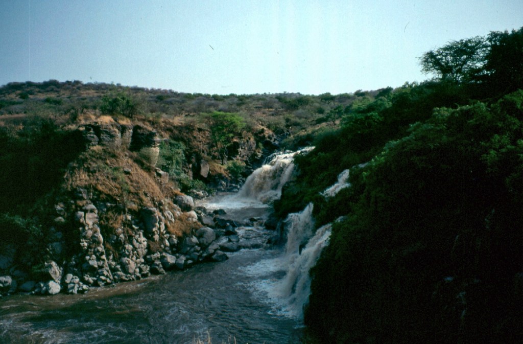
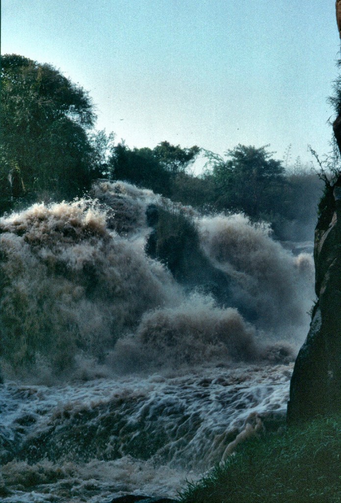
It had large areas of Acacia woodlands with patches of grassland. The Addis to Harar road divided the park and separated the Illala Saha Plains to the south from the Kudu Valley to the north. In the south of the park the Awash River gorge had amazing waterfalls that, together with the Awash River gorge are the dominant features of this part of the park.
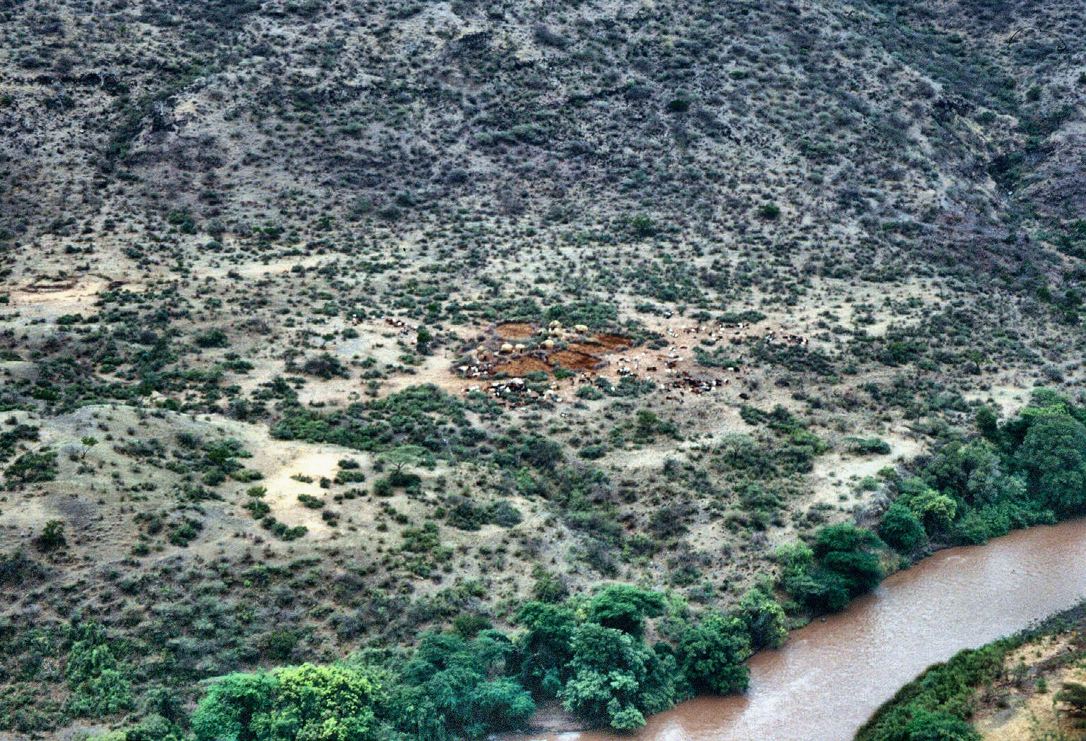
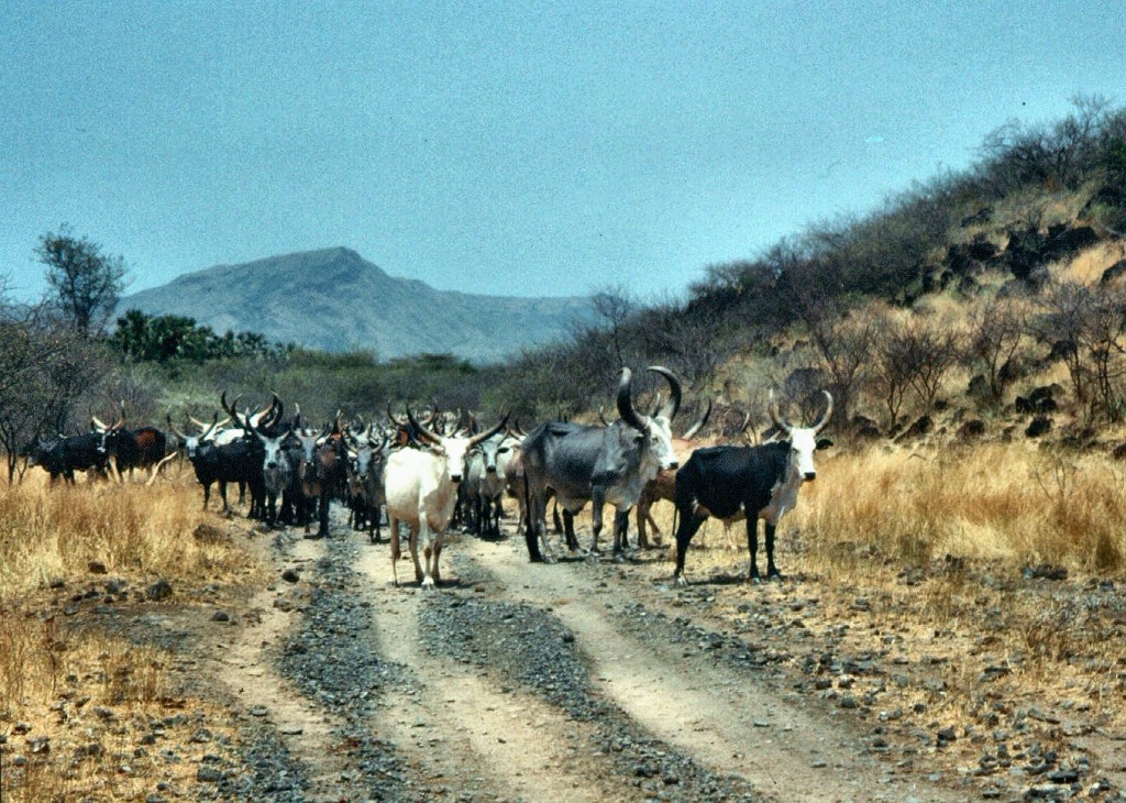
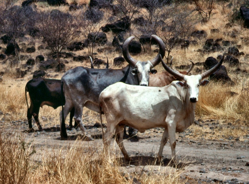
We stayed in bungalows located near the park headquarters but I fail to remember the name. The place offered a most magnificent view from the park headquarters. We thoroughly enjoyed watching while on the other side of the gorge cattle people were going about their business, going out of the kraals in the morning with the bells of their cattle sounding loudly and returning in the evening to spend the night under the protection of the thorn enclosures. Again, a sight that brought me back to my time with the Maasai in the Transmara.

There were not many roads at the park, but we managed to go for game drives during which we spotted a few animals such as East African oryx, Soemmerring’s gazelle, Salt’s Dik-dik, Lesser and Greater Kudus, Warthogs and Olive Baboons. We also saw interesting birds that included the North African ostrich and the Abyssinian ground hornbill and Abyssinian roller to name some of the rarer ones.
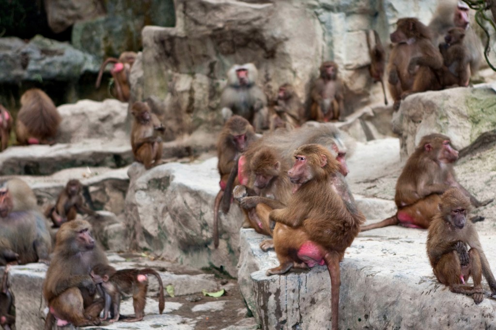
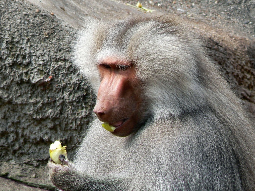
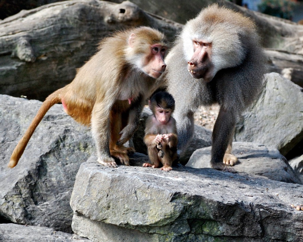
Of great interest were the Hamadryas Baboons (Papio hamadryas) [4] that are rather unique and present in large groups. These baboons are native to the Horn of Africa and the southwestern part of the Arabian Peninsula. The most striking feature of these baboons was the silver and white mantle that the males had while the females do not have it and they are brown all over.
During the drives we caught sight of the nice waterfalls and in one of our visits the river was running fast and this added a touch of drama to the sight. We spotted a few crocodiles but we needed to work hard for them and the same happened with the hippos that were there but more often heard than seen.
We also visited the northern part of the park that consisted of a 30 km drive from the main road to reach the Filwoha area and its well-known Hot Springs. This is Afar country and during the drive we saw a number of herdsmen with their beautifully looking cattle.
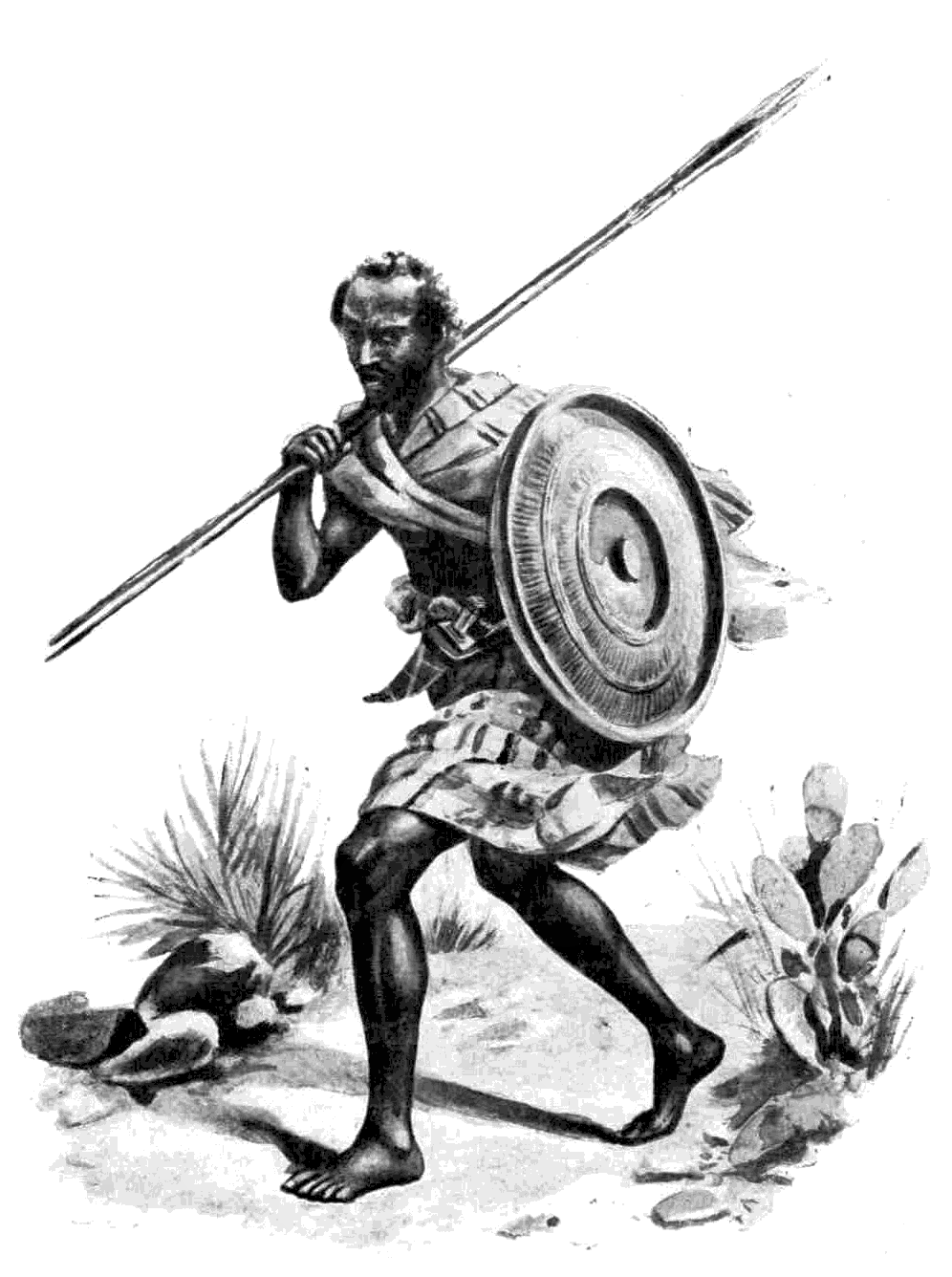
On arrival we met the Afar (also known as Danakil) people that resided in the area and that offered their services to guide us to the springs that we declined. They were truly fierce looking, a fact that concurs with their warrior reputation. As usual, for respect (and fear this time!) I refrain from taking pictures of them.
The springs looked beautiful and refreshing in the severe heat. Their water was of an amazing turquoise and they were framed by doum palms. I must say that they were very inviting but they were not as refreshing as we thought. They were very hot, particularly one known as the “Emperor pool” in which it was almost impossible to keep your hand inside it for more than a few seconds! If it was used by an Emperor, it must have been a tough one!
[1] There is a movie called “Shashamane” produced in 2016 for those interested in following up the subject.
[2] The term “Ras” means a duke or prince in the Ethiopian Semitic languages; “Tafari Makonnen” was his personal name.
[3] Thesiger, Wilfred (1998). The Danakil Diary. Journey through Abyssinia 1930-34. Flamingo publishers. 240p.
[4] For more on this species see: https://en.wikipedia.org/wiki/Hamadryas_baboon
