Rift valley

Windsurfing with hippos

As you will learn later, I took up windsurfing during our holidays at the Kenyan coast but I never got beyond the beginner’s level, basically due to lack of practice.

There are two fresh water lakes in the Kenya Rift Valley, Naivasha and Baringo. The former is a weekend destination for many people in Nairobi that we use to call “water babies”. The lake was not a reserve and it was open to people to sail and fish at will while staying in the various luxury hotels spread along its shores [1].

Lake Baringo is much further away to the dry north and to get there requires quite an effort and it is not really suitable for a weekend break. We visited it sometimes as a stopover when heading for other destinations and perhaps twice as our final destination.

Lake Baringo has an area of 130 square kilometres and the Molo, Perkerra and Ol Arabel Rivers are the rivers that feed it. It has no known outlet but it is believed that its water seeps through the bottom into some underground current where it finds an impermeable layer. There are over 470 species of birds there, occasionally including migrating greater flamingos as well as a Goliath heronry located on a rocky islet known as Gibraltar that is an amazing sight!

baringo island camp

Island camp.

The lake was believed to bee free from Schistosoma parasites and also that its crocodilian inhabitants, because they were not disturbed, also did not bothered swimmers and sailors. The hippos, however, were “normal” and it was advised to give them a wide berth, as there were quite a number, particularly near the shores. Despite this potential danger the local Njemps fishermen moved about the lake in tiny boats and rowed with some special paddles that they fitted in their hands!

baringo best

Young Njemp rowing in the lake.

We always camped at Robert’s Camp and we spent time walking and driving around the lake in search of some of the rare birds that were present there. One occasion we shared the camp with some colleagues from Muguga that were keen on sailing and they had also brought their windsurfing gear.

They insisted that I borrowed it to have a go. I put forward the excuse of the low temperature of the water trying not to mention my concern for the hippos and, to a lesser extent, the crocs but they insisted.

I had seen the abundant hippos present at the lake and pointed this out to them but they convinced me that, as far as they knew, there had never been an accident with either hippos or crocs. Seeking consolation in the way the Njemps fishermen move around the lake, I thought that the windsurfing table must have been at least twice the size of their boats and, therefore offer more protection in case of an attack.

So I bit the bullet and ventured into the lake! It all went well starting in the open water, far from the shore and eventually my friends, seeing that I would manage on my own, went on sailing, faster than me and soon I was forgotten by all!

JC windsurfing from slides 1 copy

Preparing to start.

After about an hour of sport, not being really used to it, I got tired and decided to head back to our camp. This meant coming closer to shore where the hippos were! Luckily I managed to sail in the right direction and eventually I got within a short distance from our camp. Now I needed to get there! This was easier said than done.

Between me and the camp there was a shallower area that could only be negotiated through a narrow canal and there, in the middle of it, a pod of hippos were doing whatever hippos do when they are inside the water as a family!

I was in a tight spot and quite concerned! I decided to do an exploratory approach to the beasts to see how they would react to my presence and then stop. I did so at about twenty metres from them and they replied with some grunting but nothing else happened. I took this as a half-hearted warning to the semi-naked human that was approaching them.

The situation was becoming tricky but in what I now regard as a foolish (but rather courageous) move, decided to go for it and gathered speed, trying to keep to the side of the channel where I saw no hippos.

Although I thought I was going fast, I am sure I would have been dead meat if the hippos wished to go for me. Luckily, they only watched me pass and snubbed me by showing me their fat rear ends! Eventually I managed to hit the coast at full speed and felt very relieved.

JC windsurfing from negatives 1 copy

Going for it.

When my colleagues returned to collect the table I was already relaxed and kept the incident of the hippos to myself.

baringo

Evening at lake Baringo.

[1] See: https://bushsnob.com/2019/11/23/lake-naivasha/

Lake Nakuru [1]

Being 160 km from Nairobi made Lake Nakuru a favourite weekend escapade as it was well known for its prolific bird life. Unfortunately but at the same time inevitable, the strongly alkaline 62 km2 lake was an island inside farmland and its borders were clearly under pressure from the rural dwellers next door as well as from the town of Nakuru looming nearby and threatening this true bird paradise with its effluent. However, at the time of our visits the park offered unique birding opportunities.

nakuru 1-- 13 6 82

A view of the lake from one of the viewpoints.

The explanation of why there are soda lakes is geological. Rift valley volcanoes spewed alkaline ashes rich in sodium carbonate that the rainwater carried to the lakes. Those without drainage allowed the sodium to accumulate and the water became alkaline. All alkaline lakes are near a volcano: Lake Natron (Tanzania) and Lake Magadi (Kenya) are near Shombole and Olorgesailie respectively, lake Elmenteita near Eburu crater, lake Nakuru near Menengai crater and lake Bogoria near the Laikipia volcanic escarpment.


nakuru 01

Approaching the lake shore.

Lake Nakuru National Park, including the lake itself, has 188 km2 and it was created to protect the soda lake that gives it its name and that lies in the center of the Rift Valley following the arrival of more than 1.5 million of flamingos to the lake in 1960. In 1961 the famous American bird artist and author Roger Tory Peterson called the massed flamingos on the lake “the world’s greatest ornithological spectacle” and this prompted the authorities to declare it a National Park in 1963, mainly as a bird sanctuary.

Clearly the flamingoes, both the lesser flamingoes (Phoenicoparrus minor) and the greater ones (Phoenicopterus roseus) were still the main attraction at the time of our visits and they alone justified the trip although the park had an amazing bird wealth as well as several interesting mammal and plant species. The lesser flamingo, by far the most numerous, had dark pink plumage as well as a magenta beak with a black tip. The greater flamingo was larger and had a pink bill and a whitish-pink plumage.

nakuru 13 6 82 mabel

Mabel watching the flamingoes.

From afar and from the various viewpoints that surrounded the lake they could be seen as a wide pink ring enclosing the lake’s water and flying over the water continuously changing positions. Approaching the shore the ring would start vibrating and soon transformed itself in tens of thousands of birds feeding, displaying, fighting, taking-off, landing, being attacked by predators from both land (baboons and hyenas) and air (birds of prey of all sorts).

Flamingoes Nakuru copy

Lesser flamingoes.

Surprisingly the two flamingo species do not breed in Nakuru and they are only there to feed, their numbers largely determined by food availability and this, in turn, depends chiefly on rainfall. If conditions are not right they move to other rift valley lakes, notably Bogoria.

The lesser flamingoes feed almost exclusively on the free-floating algae that grow only in alkaline water. These algae, known as Spirulina, had grown over thousands of years and the millions of flamingoes that feed on them are the final result. With their heads upside-down, their tongues pump the water that gets filtered in their specially modified spongy beaks trapping the algae. To thrive they need about 150g of food per day, that had been calculated to be a total of 150 metric tons per day to feed the more than a million birds that constituted the Kenya bird colony!

The greater flamingo, much less numerous, fed on shrimps and small fishes and they were present in most lakes, including sometimes in the freshwater ones.

For some visitors the lake was as beautiful as treacherous. The road around the lake was an innocent looking track made of volcanic ash and soda that, although it was dry, it was in fact very soft and muddy below. Some motorists ignored the warning signs and their car wheels would break through the thin crust and sink. They would then find themselves helplessly buried in soft and sticky ash and it was not unusual to find abandoned cars waiting for the park authorities to be able to enter with a tractor to recover them!

Although we admired the flamingoes, the great white pelicans (Pelecanus onocrotalus) were our favorites. Their numbers estimated at nine thousand, they stayed apart from the flamingoes and mainly grouped at the southern end of the lake at the appropriately named Pelican Corner where, in a horse shoe formation dipping their heads in unison they would feed on Alcolapia grahami, an alkaline-tolerant fish very close to the Tilapia species. The group surrounded and gradually forced fish into shallow and warmer water, flapping wings and plunging bills to catch them along the way.

But it was flying that they were truly astonishing. When the air’s temperature started to increase they would take off and, like the vultures do, find the right upward-moving thermals and climb until they reached the right altitude and then they would move on like a squadron of bomber planes, hardly beating their wings towards other lakes such as to Naivasha to the south. Although they can be seen as ugly on land, they are one of the most graceful birds I have seen flying!

This slideshow requires JavaScript.

Bird life was so prolific and abundant (more than 450 species of birds had been recorded at the time we were there) that a challenge we aimed for when we felt active enough was to get up early in the morning and return for “brunch” having spotted one hundred different species! Perhaps because we were not “true” birdwatchers we never achieved this goal but it was not rare to arrive at 80 species and above every time we attempted it!

Lake Nakuru is very picturesque as it is surrounded by several volcanoes: to the north is Menengai crater, northeast the Bahati hills, east by the Lion hill, south by the Eburu crater and west by the Mau escarpment. The road around the park was a great way of seeing the lake and its many features as well as seeing how close the farmers were on the other side of the fence!

It was a long drive to complete the circuit as the lake has a surface of 62 km2. The road went through rocky hills and our favourite were the Baboon cliffs that, in addition to the strong hyrax urine smell, offered great views across the lake. It was from there that we watched the pelicans fishing and flying.

bushbuck

Defassa waterbuck in Nakuru.

Defassa waterbuck predominated in the areas of high grass and hippos were present in the northeastern corner of the lake where the alkalinity of the water was lower because of the entry of fresh water from the Njoro river and other springs. There was a small pod of hippopotamus living in that area. Nakuru was also a good place to see Bohor reedbuck and black and white Colobus monkeys.

Rotschild’s giraffes were successfully reintroduced in the late 70s and a rhino sanctuary was started in 1987 that was managed by our friend Jock, the one that we had met in Naivasha earlier. Unfortunately, despite several invitations, we never visited it as we were getting ready to move from Kenya at the time the sanctuary started.

The absence of lions and the few buffalo present made the park safe for limited walking and, although spotted hyenas would visit your camp nightly, they never troubled us and, over the several years we visited the park, we only saw a leopard once from the car while driving after sunset.

nakuru buffaloes best

Some of the few buffalo we spotted in Nakuru.

nakuru 01.jpg

We always camped near the main entrance at a grassy campsite under the shade of very large yellow bark acacias (Vachellia xanthophloea) in the company of the beautiful black and white colobus monkeys as well as the less pleasant visits of vervet monkeys and baboons. The place provided great freshness and I recall spending long hours writing scientific papers there while Mabel put up with me walking about the camp always finding entertainment and finding interesting things to watch.

When our Uruguayan lady friends Elcira and Marta came to visit us in Kenya as part of their life-long world-trotting, Nakuru was the place we took them camping, precisely because of its safety and the spectacular sight of the thousands of flamingoes and other birdlife. It was a great success and we spend a long time watching the flamingo antics [2].

Nakuru has diverse vegetation including woodlands with sedge marshes, dry and seasonally flooded grasslands, and various types of dry wood and scrubland that occupy the land between the lake waters and the escarpment and ridges. Of note are the patches of large yellow bark acacia woodlands as well as the nicest Euphorbia candelabrum forest near the Lion Hill Camp.


[1] The meaning of Nakuru: “the place of the waterbuck”; “the place where the cows won’t eat”; “the dusty place”, “the shifting place”; “the place of smoke”; “the place of the dust devils” See: https://archive.org/stream/cbarchive_101865_meaningofthenamenakuru1960/XXIII_No.7__104__303_1960_Kirby_djvu.txt

[2] See: https://bushsnob.com/2019/09/08/the-joys-of-camping/

Suswa caves

The rift valley owes its existence to humongous volcanic upheaval that my mind cannot even start to imagine as we can only see the effects of this conflagration millions of years after it happened. Among the consequences that we see today are the several volcanoes that are scattered throughout its extension.

rift valley suswa...

Mt. Suswa from the distance.

Two are close from Nairobi: Longonot and Suswa. The latter lies south of Longonot and about 50 km northwest of Nairobi. We did not visit Longonot as it implied leaving the car unattended and a long walk to the rim of the caldera. However, we did visit Suswa in several occasions as it could be reached after about two relaxed hours of a picturesque drive from Nairobi. Together with lake Magadi, it was an ideal day out although the road was rough!

land rover on suswa rd

On the way to the Suswa volcano.

The drive took us through Maasai country and there were large herds of cattle grazing on the way and around the volcano with its almost 100 km2 caldera that has a large cone towards the southern part. We saw a few giraffe, Thomson’s gazelle, zebra and hyena spoor although we never saw one.

It seems that Suswa erupted violently during the Pleistocene and this created a unique double crater with an inner crater surrounding a large block of rock. There have been more recent eruptions, perhaps one hundred years back that have expelled lava from side vents as the remaining lava flows still denuded from vegetation show.

At the time we believed that there was no water inside the caldera so we never went down and we did not see animals down despite is luring greenery.

suswa crater 1

A view of the crater.

The volcanic activity had contributed to another interesting feature: caves. These were large and they could be reached through several entrances, some easy to find and others hidden among the rocks and vegetation. While searching for the openings, great care was needed not to fall through one of the hidden holes as cows sometimes did.

There were also some rock ledges with clear signs of earlier human habitation as well as indications that these may have been used by predators, probably hyenas.

Once you entered in the caves the atmosphere became cooler and humid and some light filtered through cracks on the roof of the caves or in places where this had collapsed over time (the very same holes you and the cows needed to avoid while walking there!).

The caves had different levels of caverns and passages created by the volcanic activity and the more superficial ones are relatively easy to access if you have torches and do not suffer from claustrophobia or scared of the dark. Some were clearly enormous lava bubbles while others were like rounded tubes of rock.

We explored those caves with some natural light as our torches at that time were not up to the task of cave exploration. There was one exception when we visited the cave with Paul that had a very powerful torch that helped us to enter the darkness for a limited period as the battery had a rather short life!

suswa caves 1

A view of one of the caves with a collapsed roof.

During that visit we managed to enter a very large cave and walked into a large vestibule with a tall ceiling and what felt like sandy floor. The roof had rock formations with various tones of red and brown and we also saw some stalactites. The air reeked of bat pee and excrement and we soon detected the “culprits”.

Our attention was immediately called by what seemed a trembling of the walls that were no other thing that a huge number of bats hanging on. We decided to leave them alone and shone the torch on the floor and then we made another discovery!

Kaldari_pseudoscorpion_01

A pseudoscorpion.Credit: Kaldari [CC0]. Wikimedia Commons.

On the bat guano, tiny creatures scurried around. As I had never seen these before I collected some and, later, I identified them as pseudoscorpions, rather small tailless scorpions of 2-5 mm which were probably feeding on dead bats. There are today over one hundred species recorded from Kenya [1].

At some point we realized that we were sharing the air with thousands of bats and the thought of inhaling nasty pathogens spurred our departure, perhaps unjustifiably but wisely! I believe the bats were free-tailed bats of the Otomops genus, probably Harrison’s large-eared giant mastiff bat (Otomops harrisoni) only described as a new species in 2015, well after our visit. These insectivorous bats are considered vulnerable by IUCN in view of the increased disturbance to the caves they inhabit.

Several movies were filmed in Kenya at the time we were there. Apart from good ones such as “Out of Africa” there were others that left a lot to be desired. Among these was “Sheena Queen of the Jungle”, starred by the then well known Tanya Roberts, the blond of the original Charlie’s Angels.

Part of the movie was filmed in the Suswa caves and I recall that a couple of Muguga colleagues that attempted to smuggle themselves into the location of the filming to peep on Ms. Roberts, were ignominiously discovered and expelled by the security guards!

The movie, released by Columbia Pictures in 1984, is truly bad from the very start that shows Sheena galloping through an open plain on a horse painted black and white! Unfortunately, to film such a bad movie the film company left lots of debris behind showing great contempt for nature.

The movie was -justifiably in my view- nominated for the worst picture, actress, director, screenplay and musical score at the 5th. Golden Raspberry Awards in 1985 and astonishingly, it did not win any! [2]

suswa caves

As the movie required some rocks falling on the bad guys (pushed by several wild animals such as rhinos!) polystyrene rocks were left behind in the caves, together with a wooden structure where the cameras were placed.

Luckily, the Cave Exploration Group of East Africa members removed the debris that had been left behind.


[1] See: http://museum.wa.gov.au/catalogues-beta/pseudoscorpions

[2] See: https://en.wikipedia.org/wiki/5th_Golden_Raspberry_Awards


Fossilized

When I wrote the post on Lake Magadi [1], I forgot to include a very interesting place located on route to the lake: Olorgesailie, located about 60km southwest of Nairobi.

oligorsalie bandas

Olorgesailie lodges.

Being almost at the bottom of the rift valley it was hot all year round and often ignored by passers-by heading for Magadi and beyond. We did stop there a few times and even stayed a couple of weekends while I was writing my PhD thesis. as it was a very quiet place.

jj writing phd bushwhakers

Working on my PhD.

The site is in a lake basin that existed there probably between 200,000 and 100,000 years ago (mid Pleistocene). The lake was fed by the long gone Ol Keju Nyiro River, displaced by the then common and dramatic earth movements. While the lake existed it attracted game and hunters and then bones and tools accumulated, got buried and remained there for eons. Somehow they eventually re-surfaced and were found, first by the “discoverer” of the rift valley, J.W. Gregory, in 1919 and later by Louis and Mary Leakey.

The Leakeys, as they are commonly known, started working in the area in 1942 and unearthed crucial evidence on the activities and life of early prehistoric peoples of the Hand axe culture. Because of the fossil wealth it contained, it was declared a small National Monument of about 20 hectares in 1947 to preserve the finds under the care of the National Museum of Kenya.

We had the chance of listening to Mary Leakey talking about her work at Oligosailie and Olduvai. Louis had already passed away by then but we also attending lectures by their son Richard also exposing his finds and ideas about the evolution of man in Africa to which the findings at Oligosailie are very relevant.

Both were lecturers at the Know Kenya Course (now re-named Know Kenya More) that the Kenya Museum Society started running in 1971 and that were going full swing in the 80’s. These series of lectures were a great way for new arrivals to get familiar with the country while getting funds to support projects of this institution in Kenya.

During Mary’s lecture we learnt that at both Olduvai and Olorgesalie heavy accumulation of volcanic ash preserved the famous footsteps in the former and the fossils in the latter. The main producer of ash at Olorgesailie was the now extinct volcano that gives the site its name that with its 1760m dominates the area.

The most important fossils in Olorgesalie were human-made tools and their abnormal accumulation in the area is evidence of early man had their camps. I recall our guide during our tour of the site pointing at tools and the flakes that resulted from their making that truly littered the ground and I seem to recall that Louis Leakey used to make stone tools to practically demonstrate his conclusions at international meetings!

Apart from stones Olorgesalie also had some living attractions. One of the “specials” were the very tame Grey-headed social weavers (Pseudonigrita arnaudi) that nested in the surrounding trees and would come to feed from your hand. It was also one of the few places in Kenya to see Desert roses (Adenium obesum) around the bungalows.

Mabel and weavers.

Desert roses (pink) and other Olorgesailie flowers.

As the area was extremely hot, we walked during the early mornings and evenings and these did not include climbing Mt. Olorgesailie as we are not climbers but to follow the several paths used by the Maasai in the area as there were still a sizeable population of wild herbivores as well as lots of interesting birds.

Apart from the ubiquitous whistling thorns [2], the area is full of another thorny tree known as “wait a bit” [3], a name that describes perfectly its hooked thorns’ ability of stopping you in your tracks. Damage control in these cases indicated reversing to unhook yourself if you could. However, when you were caught jumping or going down a ravine unable to stop the damage to your skin could be rather painful and bloody. Most of the time I ended our walks not only dusty but bleeding from arms and legs. To add insult to my injuries my wife -rather miraculously- ended up dustless and unscathed, a trait she maintains up to date!

It was not rare to find Maasai herdsmen walking their cattle to the scarce watering points located in the area. They would follow the dry riverbeds that crisscrossed the area to find water. It was in one of these dry rivers while driving to get to Olorgesailie that we met a Maasai herdsman at really close quarters.

cattle Magadi rd.tif

The picture that prompted our meeting with the Maasai, seen at the bottom of the picture.

I took a picture of a herd of cattle drinking by the road, something that their owner did not appreciate and, before I knew it, he was inside the back of our kombi where he joined a very close lady friend of ours that happened to be traveling with us at the time. The man was upset and started arguing with me about the picture leaning forward and trying -unsuccessfully- to grab my camera while I was trying to calm him down and explain him that I was taking a picture of the scene and not of himself!

Unfortunately, during the rather protracted exchange he placed himself in front of our friend who, for a while, had an unobstructed view of his rear end until, when more relaxed, even sat on her lap! Eventually the message went through and the Maasai departed to join his animals, I kept my picture and our friend the “views” and the achievement of having a Maasai on her lap! The incident has remained one of our indelible memories of the times we spent together in Kenya.

At the same spot, a couple of years later we had a different encounter. A leopard had just drank at the same waterhole and it was returning to its territory and decided to cross the road. Totally unconcerned by our presence, after staring at us at leisure, proceeded to climb the rocks on the other side of the road before I could even touch my camera! It was one of the very few encounters with leopards we had in Kenya.


[1] See: https://bushsnob.com/2016/05/07/pink-gem-but-smelly/

[2] These plants that I knew as Acacia drepanolabium (now Vachellia drepanolobium) produce swollen hollow thorns inside which several symbiotic species of ants live. The wind blowing over the holed bulbous thorns it creates a clear whistling noise.

[3] Senegalia brevispica


Traveling to Intona

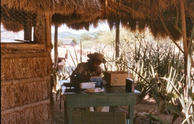
While in Kenya in the 80s, periodic trips to the Transmara were required to run the tick and tick-borne disease fieldwork. At the beginning we took turns with Alan (Alan Sidney Young) for visiting the area but gradually -as I learnt the ropes- he delegated the work to me. As a consequence -not at all undesirable- my trips became more frequent and I found myself driving to Intona every two or three weeks, depending on my other commitments at Muguga.

We needed to personally check the on-going field work and to collect the data gathered on a daily basis by our herdsmen that we would later analyse when back at Muguga. Luckily we also had a veterinarian on the ranch that Joe [1] had employed before I arrived. His name was Kiza and he was a refugee from Uganda that really helped a great deal with our work and he would radio us if there were any issues that needed our presence and, in that case, either Alan or myself would travel to the ranch to deal with them.

Equally important was to replace our field workers as we had a roster that we needed to maintain. In particular the Kikuyu workers found their stay among the Maasai rather trying and they were always ready to go home! After a while I realised that the trip to Maasailand was almost taken as a trip to a foreign country by them, used to stay in the highlands and to cultivate their land. As the trip to Intona progressed, their conversation became less animated! The reverse was also true, they became happier as we got closer to their home area, particularly the moment the Kikuyu escarpment came into view on the eastern wall of the Rift valley.

The trip would start in the early morning from Tigoni (later on from Nairobi) via Muguga where I would collect the herdsmen on duty for the period. Then there were two obligatory stops: at the local market near Muguga for them to buy vegetables, mainly humongous cabbages to prepare the ugale “relish” [1]. Cabbages would keep well and they were very popular. The next stop would be to load fuel at the junction with the main road (Nairobi-Kampala). Only then we were ready to go.

During the rainy season we would follow the tarmac through Nakuru, Kericho and Kisii to Kilgoris and then to Intona. Only the last 40km were dirt but passable most of the time. This way would offer superb views of the Rift Valley and its lakes (Naivasha, Elementaita and Nakuru) as well as its volcanoes (Longonot and Suswa).

We would also cross the large and tidy tea plantations of Kericho where we would normally brake the journey to stay at the colonial Kericho Tea Hotel. Need I say that the tea was probably the best I have ever drunk.

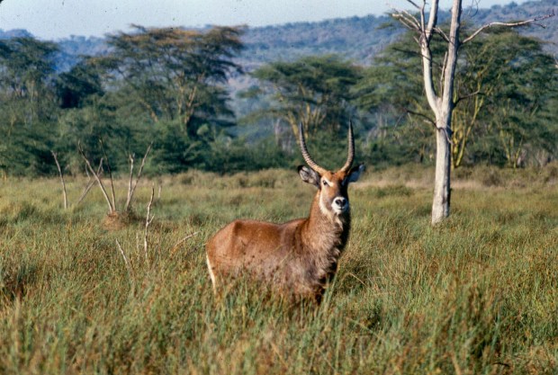
The dry weather route to Intona would take us North through Uplands and then we would start winding down the Kikuyu escarpment, pass the small Catholic church built by the Italian prisoners of WWII to continue until we branched off towards Narok. We then traversed the Great Rift Valley from East to West. In those days the savanna was dotted with antelopes and the only signs of human presence were a few small shambas [2] at the start of the road and, a few km further on, a satellite station with its giant white mushrooms.

The road skirted the lava flows from the dormant Longonot and Suswa volcanic cones and then we would climb the opposite wall of the valley where, a few km later we would get into Narok. The latter was, as expected, a predominantly Maasai town and it was the last large town on the way to the Maasai Mara Game Reserve and beyond, where we were going. We usually re-fuelled and bought the last needed items there before continuing our journey

narok town and maasai cattle copy

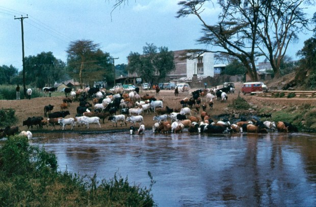
Going out of Narok. Maasai cattle drinks at the dam while the traffic goes by. Note the red VW kombi, the dominant minibus at the time.

Out of Narok we would follow the road past Aitong –where the early trials against theileriosis were carried out by Matt and co-workers before my arrival- and continue skirting the Maasai Mara Game Reserve, effectively the northern continuation of the Serengeti National Park in Tanzania, until we reached the Mara River bridge. If time allowed we would go on, otherwise there was a nice camping spot by the Mara River, next to the Mara Buffalo Camp (prior to the bridge)  where we would spend the night under canvas.

While I camped, the workers would stay at the Drivers’ accommodation at the Camp, courtesy of its Swiss Manager that would let us use it. I usually invited the workers to come to my camp in the evening for a drink and noted that there were always an extra pair of people that would come with them.

The first time this happened I thought that they were taking advantage of my hospitality and I was surprised as I did not expect this from them. I was immediately proven wrong when, as soon as they arrived to my camp, the two “escorts” would turn around and return to the lodge only to return to fetch the workers one hour later. When I asked why two people came I was told that they feared the animals too much so that they would not walk alone in the dark under any circumstances!

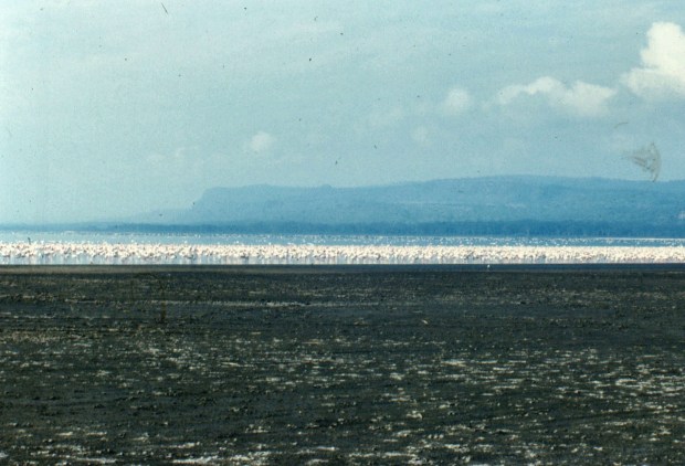
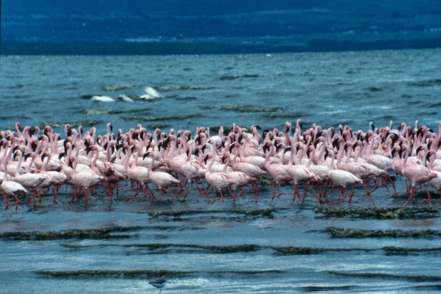
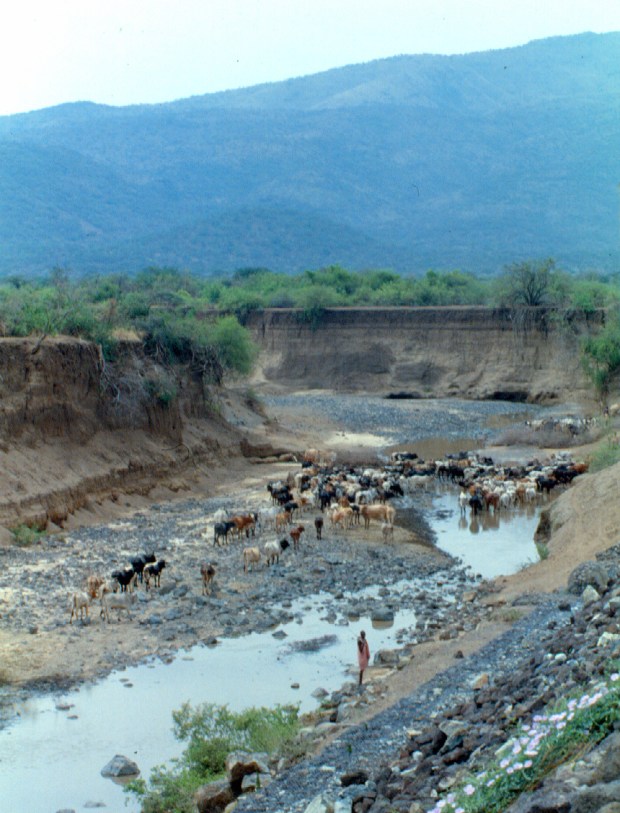
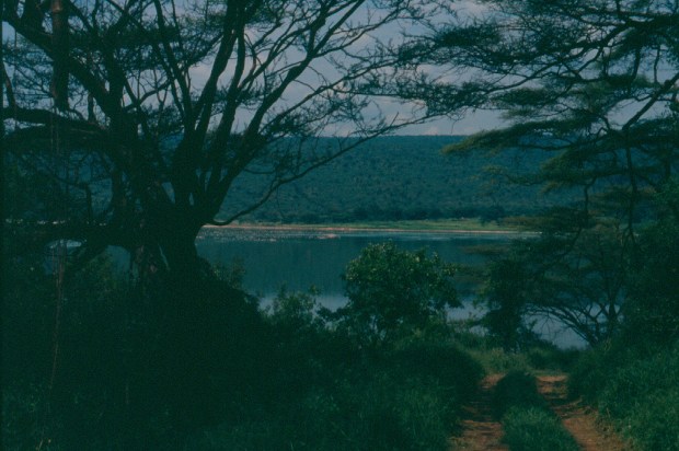
The Mara River is the main natural barrier for the migration of wildebeest and zebra in the Maasai Mara/Serengeti ecological system. It ends its course at Lake Victoria with an approximate length of 400km after its origin in the Mau Escarpment in Kenya.

Hippos Mara river copy.jpg

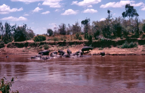
Mara river in the Maasai Mara and inhabitants.

The river is the main water source for the large population of grazing animals both wild and domestic as it always carries water, despite its flow getting reduced in the dry season. More recently (after our departure) changes in land use that have caused decreased vegetation cover are triggering a faster run-off of rainwater and flooding has become more common, particularly in large parts of the Tanzanian Mara basin.

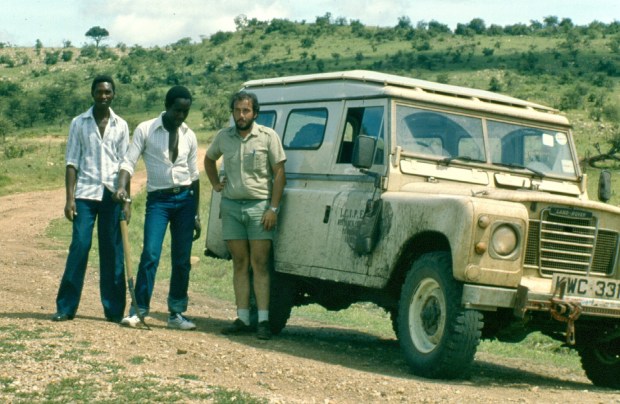
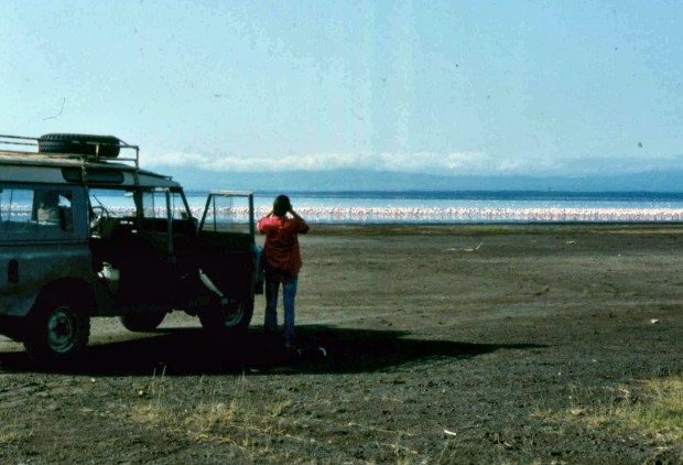
For the journey I never drove anything but a Series III Long Wheel Base Land Rover (the two door van type) and these were hard to ride but truly unbreakable. Despite traveling alone most of the time, I never broke down over the many years I did this trip. After a few journeys, I got to know the people at Kichwa Tembo Camp (Elephant’s Head in Ki-Swahili), one of the camps close to the Mara River bridge, and they were very kind repairing the occasional punctures that were my only concern!

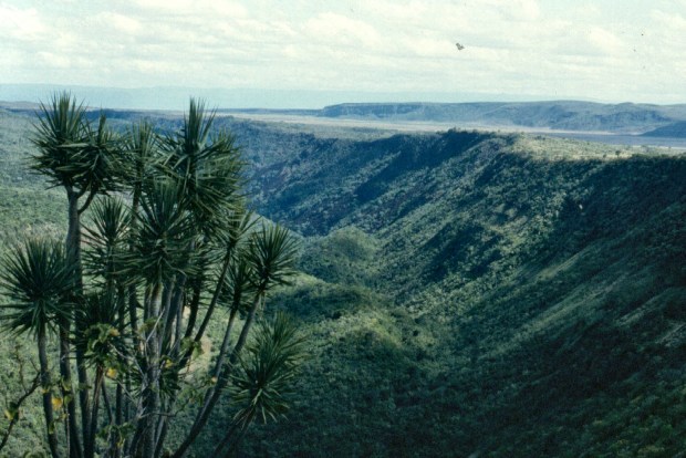
After crossing the Mara River where there was usually a Maasai cattle traffic jam and, during the wildebeest season quite a number of wildebeest as well (both alive and drowned at the river), we climbed the Oloololo escarpment and, once at the top, we had a compulsory stop to take in the magnificent view.

Below us was the Mara triangle where the green ribbon of the Mara River could be clearly seen snaking its way towards lake Victoria. When the wildebeest were in the Mara the savannah was dotted with thousands of wildebeests and zebras walking in long lines as far as the eye could see. The scene of the poster of “Out of Africa” was filmed from the Oloololo escarpment, looking at the Mara Triangle below.

m mara and olooloolo cropped

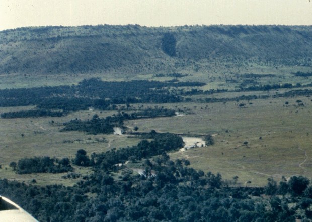
The Mara river with the Oloololo escarpment at the back, seen from the air.

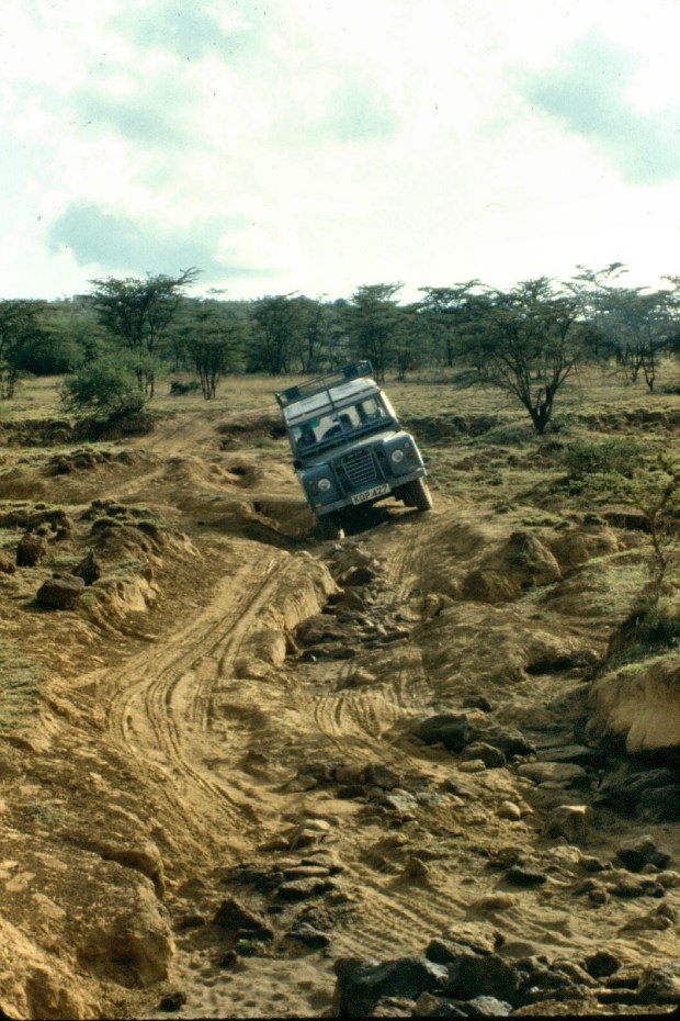
As we still had some way to go, we moved on on the now flat top of the Oloololo escarpment. After a few km the road would pass through wheat fields. This unexpected sight was the result of some Maasai communities that had leased their land to commercial farmers. Once we passed the wheat the road became a track that with great luck it would be dry and rough but more often wet.

mara wheat harvesting

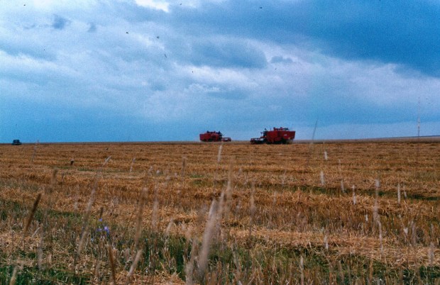
Harvesting wheat in land leased from the Maasai.

The area was waterlogged and driving was through sticky mud. The car wheels would get into two parallel from where you could not deviate! So, while you kept the car crawling in second gear you hoped that no one would be coming from the opposite direction as the crossing would invariably end with one (or both) stuck!

stuck going to intona from kilgoris copy

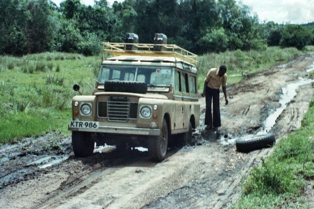
Stuck on the way to the red hill on a Land Rover station wagon that I rarely used and about to use the spare to lift the car from the muddy hole.

It was on one of these wet drives that we met a Peugeot 504 [3] buried and, after lots of digging, pushing and pulling, we managed to get it going. Unfortunately while doing this we got stuck! I looked at the occupants of the Peugeot for their solidarity but all I saw was their backs and, oblivious to our requests of help, they ignored us and drove off leaving us to dig ourselves out for quite some time and therefore to arrive very late to Nairobi.

Further on the road had another infamous section: the red hill. As its name indicates it was a steep climb over a red muddy hill with a smooth and innocent-looking surface that when you were on it it was like driving on a gigantic soap. The car, despite the 4×4 would skid the way it felt like and all you could do was to hope that it would stop before going down over the side that looked like the end not only of that journeys but of all journeys! To go very slowly and to stop as soon as the car started to skid was the only way to negotiate it but it was not easy and required total focus.

If you were successful over the swamps and the red hill then you were almost there as, from then on, the road would be firm and you would arrive to Lolgorien. This was a small village where the German Technical Cooperation Agency (GTZ) had its veterinary project in support of the Government of Kenya. It was there that Gerhardt, a veterinarian, and Anne Marie, a laboratory technician, worked.

Past collaboration between them and Alan on the epidemiology of the cattle diseases in the Kilae area nearby, that gave Alan the idea of immunise cattle against theileriosis and brought him to Intona ranch.

moll kilai lab t mara showing changaa cans! copy 2

Gerhardt and Anne Marie bush lab. An amazing place in its simplicity and efficiency.

Gerhardt and Anne Marie successfully ran several interesting activities in support to the Maasai communities and they had an amazing field laboratory where they had all essential equipment, operated by generator and or batteries, as there was no electricity there at the time. It was a revelation for me to see how advanced work could be done under really basic conditions [4].

After passing Lolgorien the road did not offer great challenges but it was important to arrive at Intona before dark. Wild and domestic animals were very numerous while driving through the Maasai Mara and still plentiful once you travel through the Transmara and it was still common to find both Maasai livestock and herds of zebra, wildebeest and gazelles on the road! As the area was wooded, their presence was more hazardous as they would appear suddenly in front of the car!

It was during one of these occasions that we came across a herd of sheep and goats that suddenly decided that the grass was greener across the road. As much as I tried to avoid them, I knocked the last sheep when, suddenly it changed its small mind and decided to turn back! The herdboy in charge run away fast before we could talk to him. Tommi (himself a Maasai) laughed and said that he must have been truly scared and run to inform his father so we waited while the animal laid motionless in the  middle of the road.

As predicted, Soon his father appeared with a grave expression, followed by the boy a distance behind. A discussion between Tommi and the sheep owner followed and I was eventually informed that I was asked to pay a large sum to compensate for the loss while Tommi advised me not to accept it. I shook my head vigorously and the negotiations continued and things were heating up when, as suddenly as unexpectedly, the sheep moved, stood up, shook his head and run into the bushes to join its mates! We were all taken aback by the development and we burst out laughing at the situation to the clear relief of the boy, the responsible of the sheep! We agreed to only compensate the owner for small injuries and left fast in case the animal fell again not to get up!

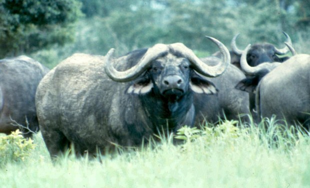
The area around Intona had a high number of people injured in encounters with wild animals. Although the rivalry between the Maasai and lions may have accounted for some, buffalo caused the great majority. It was therefore not uncommon that, having motorised transport, we would be asked to take some injured person to the nearest hospital. In addition, cattle rustling was quite common and the Police (Anti Stock Theft Unit) were a tough lot and two or three times I needed to carry prisoners and even dead rustlers (corpses).

Back to the trip. After Lolgorien we would eventually cross the Migori River that flows in a south-westerly direction from south-west Mau joining the Kuja River in Central Kadem and ends in lake Victoria. On a lucky day, turning the bend before the bridge you could watch a family of the rare Giant Forest Hogs (Hylochoerus meinertzhageni) grazing in the meadows by the water edge. They were mostly indifferent to the car and allowed us to have a good look before they slowly retreated into the riverine bush.

A few km further we would get to the large fig tree that indicated the entrance to Intona Ranch and soon cross the one plough furrow that was all that indicated its boundary! It was a full day drive but not all was over as I still needed to set up camp, have a shower, dinner and then get good sleep to recover from the long journey to be up the following morning at the crack of dawn to work with our cattle.

intona fig tree marking entrance to ranch cropped.jpg

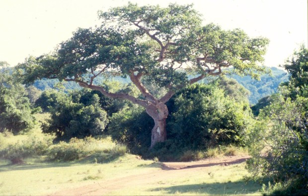
The Intona fig tree.

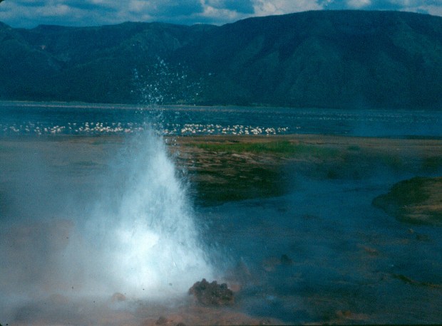
Intona was under the influence of Lake Victoria and it usually rained in late afternoon. This was preceded by the most spectacular cloud formations and amazingly beautiful sunsets when the sun would go down through the cracks of enormous cloud formations. The drama would even increase when the burning of the land, prior to the rains, would take place. This would stain the sky with a red tinge that would give the landscape an eerie appearance, as the reddish sun rays would filter through the forest. If you were lucky, you could spot a flock of the large Silvery-cheeked hornbills returning to their roosting places by the Migori River.

The return journey would start as early as possible, after finishing the work with the cattle, always done during the early morning to enable them to go out grazing with the rest of the herd. There were two reasons for an early departure: avoid the afternoon rains while still on the dirt roads, either in the Transmara or in the Maasai Mara as well as to arrive in Kikuyuland before dark.

Coming back intona with Benson and J Ndungu copy

Coming back from Intona we take a rest after reaching the Oloololo escarpment. The muddy waterbag hanging from the mirror tells the story of the journey.

The herdsmen that were due to go home did not need to be reminded and they were ready well before departure time as they missed their places and families. The ones that remained looked rather gloomy and, although I reassured them that I will return in two weeks, their moods remained somber until our leaving.

Mid afternoon would normally find us refuelling at Narok and, without wasting time, go on and cross the Rift valley. As the trip progressed the herdsmen would become more talkative and the moment that the Kikuyu escarpment came into view, they became excited and happy and they would start talking and laughing among themselves, no doubts planning their stay with their families.

Eventually we would climb the escarpment and enter in what was then still known as the “Kikuyu Reserve” to deliver the herdsmen to their homes. This was a long and tortuous drive through dirt roads to find their houses and, eventually when I was alone, the way out! As I am not too good at bearings, this would often take the wrong turn and get lost in the increasing darkness, delaying my return even more!

Although I never had a problem driving through the area, I recall an opportunity when I was driven by one of the ICIPE drivers that refused to drive inside it. He was from the Luo ethnic group, traditional enemies of the Kikuyus. He asked me to leave him at a shop on the main road and I drove, delivered the herdsmen and fetch him for him to drive me back!


[1] Ugali, a polenta-like dish-  is the main food in Kenya and other African countries. Maize flour is used and prepared using boiling water to form a semi-solid paste, served with a meat stew and/or vegetables known as relish.

[2] Shamba in East Africa is any field used for growing crops. (https://www.collinsdictionary.com/dictionary/english/shamba)

[3] At the time, a 504 was “the car” to have in Africa and it was commonly known as “Simba” (lion in Ki-Swahili) for its symbol in the front grille.

[4] Known sarcastically among us as “ILRAD 2” comparing it with the International Laboratory for Animal Diseases of those days, a multi-million USD state of the art institute based in Kabete, Kenya.


Family planning

It was during the already described picnic in the Rift Valley[1] that I first came across the Maasai method of birth control in sheep!

You will recall that when we arrived to the tree we had selected, it was already “booked” by Maasai boy herders and their sheep and goats. We eventually managed to get a tree for our picnic albeit reeking of sheep and goats urine and covered in faecal pellets!

Picnic Narok rd copy

The occupied trees…

It was during our negotiations with the herders that I noticed that a ram was actively pursuing a ewe that was clearly on heat. After a while the female accepted the male and the ram mounted her. At that time I realized that the latter was wearing a leather apron that -like a reverse chastity belt of medieval times- stayed between its penis and the ewe’s vagina, frustrating the act!

Maasai Birth control picnic tree rd to Narok

Earlier I have pondered on how the Maasai and other pastoralists synchronised their lambing to happen at the right time when the flocks included males and females grazing together. My conclusion was that it was due to the ewes not going on heat until the right time. To see this rather clever contraceptive method gave me another reason for the animals having their lambs at the right time.

[1] See: https://bushsnob.com/2018/09/30/picnic-in-the-rift-valley/

Pink Bogoria

All the Kenya lakes have their own unique characteristics and attractions. To pick one as “the best” is impossible, at least for me. However, lake Bogoria was one of our all time favourites when it came to a short break. You did not go there to find the Big Five but in search of tranquility and to enjoy the views and bird fauna. It was here that I spotted my first and only three-banded courser (Rhinoptilus cinctus).

Credit John Gerrard Keulemans [Public domain], via Wikimedia Commons Three-banded coursor

Three-banded courser. Credit John Gerrard Keulemans [Public domain], via Wikimedia Commons.

It was also a special place for another reason. It was my first camping experience in Kenya. It happened over a weekend with Muguga House colleagues Richard and Phillip. Of the outing I recall that we departed on a Saturday to return the following day. We left rather late as Richard had lots of work to do to keep the tsetse parasitoids in his lab going. A late departure meant that we could not enter the park that day and needed to camp outside the gate.

As I had no tent and only a borrowed camp bed, I slept “al fresco” as it was -I was told- a very arid and dry area. I still recall the thousand of honking flamingoes flying overhead throughout the late afternoon and well into the night.

Luckily I woke up with the first raindrops and before getting soaked -together with my bedding- I managed to enter Richard’s car. After a while I realized that it was going to be a tough night. The location of the hand brake made sleeping across the front seats of a packed Toyota Corolla impossible.

I slept in a seated position and the following day I was very tired and with a few aches. Despite my condition, the few hours we spent there were enough to appreciate the beauty of the place and to remember to come back.

Lake Bogoria is a volcanic lake framed by green-blue hills. Its waters are greenish saline (up to 100 g/L total dissolved salts) and alkaline (pH:10.5). It lies in the Kenyan portion of the Rift Valley, south of Lake Baringo and a little south of the equator. It is a rather shallow body of water that is no deeper than 10m of depth. This rather small lake of 34km long by 3.5km wide has been protected since 1973.

NASA's World Wind program copyright 2010

Lake Bogoria from the space. Credit: NASA’s World Wind program copyright 2010

Lake Bogoria’s beauty is already evident at first sight! After climbing one of the several red hills you need to negotiate to get there through the Emsos gate a misty dark green body of water framed by pink startles you at first until you realize that the pink borders are tens of thousands oflesser flamingoes (Phoenicoparrus minor) with a smaller number of greater ones (Phoenicopterus roseus).

Bogoria view from distance 2.tif 5.30.23 PM 5.30.51 PM copy

The first view of Lake Bogoria.

While greater flamingoes feed on invertebrates, mollusks and tiny fish, l and insect lesser flamingoes feed primarily on Spirulina algae which grow only in very alkaline lakes. Although blue-green in colour, the algae contain the photosynthetic pigments that give the birds their pink colour. Their deep bill is specialized for filtering tiny food items.

246 copy

A view from the eastern shore.

Bogoria view from distance 1.tif 1.15.23 PM copy

Moving pink islands.

These birds were part of the largest world population of flamingoes that migrated among several of the Rift Valley lakes such as Natron, Magadi, Nakuru, Elmenteita and Bogoria. For some reason, the latter is one of their preferred stopping places. At the time the flamingoes seemed to commute mainly between Bogoria and Nakuru although their breeding took place mainly on the caustic lake Natron in northern Tanzania.

421

Lesser flamingoes.

A few months after my first safari and following my wife’s arrival lake Bogoria was one of the first places we visited once we got our VW kombi and some camping gear. At first we camped at the Acacia campsite on the southwest shore but soon we realized that either camping at the Loburu hotsprings on the western shore or at the Fig tree campsite in the southeast were nicer alternatives.

Bogoria hotsprings.tif 8.11.45 AM copy

Loburu hotsprings with immature lesser flamingoes in the background.

The southern end of the lake is almost separate from the remaining body of water towards the north but for a small channel in the eastern section. It is in this area that large numbers of flamingoes were often spotted. It was a photographer’s paradise and I still remember a friend’s great idea of taking pictures of the birds in full moon only to arrive at the lake when there was a full eclipse!

Although staying near the Loburu hot springs added a few extra degrees l to an already high temperature, the various steam jets and hot water rivulets around camp contributed to make it an interesting and misty place. Although walking among the hot springs was hazardous, it was quite an experience and its water greatly facilitated the needed camping dish washing!

230

Hotsprings and flamingoes.

The springs are quite powerful and they create short streams that feed the lake and some had formed cones while others gave raise to small pools, some over two metres deep and very hot as the temperature of the springs varies between 39 and 98.5 °C . Unfortunately, instances of severe burning of campers falling in had occurred by the time we got there!

Our favourite camping ground was the Fig tree camp, a very shady area under a patch of magnificent fig trees that provided the necessary thick shade. The camp was traversed by a clear stream coming down from the Siracho escarpment just above the area. We sometimes drank from it in cases of need as a good friend assured us that it was clean water. It did taste great but a few years later we were in for a surprise: we discovered that higher up in the hills it went through a local village!

We spent many cool nights under the trees but there was one exception that, apart from cool it was “entertaining”. Unknown to us the rather large resident baboon troop had decided to spend the night up the fig trees above us! This had probably happened during earlier stays and it had gone unnoticed. The night in question, at about midnight, all hell broke loose as something seriously scared the baboons, possibly a leopard although we never saw it. We only suffered the consequences.

It seemed that the entire troop was above us! Their fright caused a number of them to violently empty their bowels and bladders. I leave the results of this barrage to your imagination! I will only tell you that the aftermath was a smelly night and lots of washing of our camp, including the car windscreen the following morning! There must have been lots of baboons! After that experience we learnt to sacrifice some shade to avoid a repeat of this situation!

During the earlier visits to lake Bogoria it was still possible to drive all around the lake and we did this a couple of times before the road collapsed. The most memorable of these round the lake tours took place with our friends from Uruguay Nazar and Aurora when we drove north from the Fig tree camp and we could slide the kombi door open to really enjoy the view. The drive was special as it offered great views of greater kudus that used to dwell on the eastern area of the lake where they could browse to their liking.

DSCN9925 6.17.49 PM 6.22.07 PM copy.jpg

Going round the lake would also enable you to see many of the more hidden hot springs as well as the some of the special features such as the Kesubo Swamp to the north. However, the geysers and hot springs along the bank of the lake were, apart from the flamingoes, the most interesting features.

Bogoria view from top of circular rd.tif 1.23.58 PM copy

Kesubo Swamp to the north of the lake.

Unfortunately in recent years the population in the two key east African lakes, Nakuru and Bogoria, have been adversely affected by suspected heavy metal poisoning, while its primary African breeding area in Lake Natron is currently under threat by a proposed soda ash plant. So, despite still being the most numerous species of flamingo, lesser flamingoes are classified as near threatened due to its declining population and the low number of breeding sites, some of which are threatened by human activities.