Every year we embark on our annual migration that covers three continents: Africa, Europe and South America. We find this ideal. Not only we avoid the bulk of the rainy season in Zimbabwe but we also get to Uruguay and Argentina to take advantage of the summer time there. After our sojourn in the Americas we avoid the winter and return to Zimbabwe with a summer stop in Europe to visit our children.
This year things changed as our son moved to Tenerife in the Canary Islands and we decided to spend the end of the year holidays there. We traveled there via Rome to spend a few days with our daughter and friends prior to our trip to Tenerife. This, unfortunately, was not the best move as we picked up severe flus that matured on arrival to the Canary Islands and kept us homebound for several days, some of them spent in bed!
Despite this, the fact that the family was together offset our sicknesses and, fortunately guided by our son we had some good time touring Tenerife and have a look at its attractions although planned trips other islands and visit to friends were cancelled.
After this, already recovered, we traveled to Uruguay where we spent a few days in the company of relatives and childhood friends. It was summer time and we enjoyed the warm weather that sometimes turned rather too hot but always preferable to the cold and wet winters that Uruguay can also deliver.
It was soon time to travel to Northern Argentina, a long but interesting journey that would take us to our farm in Salta “La Linda” (the beautiful) as it is known in this latitude.
After a few years of traveling this route we have decided to divided into three legs of about 600km each. The first takes us to Mercedes in Corrientes, the second ends in Presidencia Roque Saenz Peña and the final one -slighty longer- takes us to our final destination in Salta. This time, because of a basketball tournament there was no hotels in Mercedes so we booked a place in Curuzú Cuatiá, a few km nearer to Carmelo.
The weather during the journey was expected to be stormy but, despite some rains on the way, we had no difficulties. After driving about 600km? we reached Curuzú Cuatiá, a small town whose name comes from cross (curuzú) as it is placed at an important crossroads with traffic to and from several important Provinces in Argentina and Buenos Aires. The Jesuits had marked this place with a large wooden cross but the local Guaraní already had a name for the place: Curuzú Cuatiá.
After a good night rest we continued North, this time under heavy rain until, …km later and driving through the Iberá wetlands, we crossed the Paraná River at Corrientes through the large bridge that joins the Provinces of Corrientes with the Chaco. This time, the waters of this wide river showed a ribbon of clear water on the side of Corrientes (the waters from the high Paraná) and a wide brown area occupying more than half of the river course on the Chaco side. The latter indicated that the Paraguay River, that joins the Paraná a few km upstream, was in flood. The view reminded me to that seen at Khartoum with the Blue and White Nile running in parallel.
A couple of hundred km after crossing the river we arrived at our destination for the day: Presidencia Roque Sanz Peña. The reader may ask why we stopping in such an unsung place. As I mentioned, we needed a stopover that would be located about two thirds of the way to Salta and, after trying a few options Presidencia (for short) was chosen. It is the second city in importance in the Chaco Province after Resistencia, its capital. Luckily we discovered that it has a comfortable hotel with a sauna, adjacent to a thermal water spa. Just a short walk away there is also a good BBQ place where a large display of various meats allows for the choice of dinner to be made. A great desert of cheese and papaya in syrup is usually tasted after a good portion of “asado” (barbecued meat).
The final leg is the harder as it is a bit further and the road offers some “challenges”! Hence we departed as early as possible stocked with plenty of water. The straight road took us across what was a vast expanse of forest known as “El Impenetrable”. The straight road traverses the Chaco and Santiago del Estero provinces before getting to Salta. It passes through places with dramatic and even scary names, some of which are worth mentioning.
The first location we find is Avia Terai, (originally “Aviauck Tadaek” meaning large or thick forest in the Toba Qom language). Unfortunately, only isolated clumps of forest remain this day although, because of its woodlands of white and red quebrachos (Schinopsis spp) a very hard (density 0.9–1.3) wood tree species whose name means “axe-breaker”; algarrobo (Ceratonia siliqua) and guayaibí (Patagonula americana) was once known as the “Fortress of the woods”. Charcoal burning, the extraction of the hard woods and the clearing of lands for cultivation (mainly soybean) have taken their toll throughout the region nowadays
You then reach Concepción del Bermejo, a rather symbolic village that evokes an earlier settlement known as Concepción de la Buena Esperanza. This early attempt at colonizing effort was founded in 1585. Although it was the most effective Spanish occupation of the Chaco Province, it came to grief in 1631 when a tribal coalition destroyed it and forced the survivors to migrate all the way to Corrientes (240km), luckily ignored by the attackers!
The string of dramatic names starts with the next settlement called Pampa del Infierno (Hell’s Pampas) that clearly illustrates the feeling of the early settlers that chose the name when confronted with the intense heat and humidity that prevailed there. The next town, Los Frentones, is another small enclave that remembers the indigenous nation of that name that roamed this area. They used to shave their heads half way up their skull appearing to have a wide forehead (frente) hence their name that means “large fronted”.
Río Muerto’s (Dead River) is the next place we crossed. Its rather gloomy name comes from a dead “cauce” associated with the Bermejo River that apparently was blocked during the Chaco conquest through which the Argentinian Government conquered the aborigines. Pampa de los Guanacos is the next town name as a herd of these ruminants? were seen in the area at some stage. The place is home to a Mennonite colony? that came from Paraguay over thirty years ago. They live their rather isolated lives working the land and producing excellent cheese that is very sought after in the area!
We then came to Los Tigres (The Tigers) where probably jaguars once lived but no longer. Here the asphalt road deteriorates taking a rather “political” characteristic that also makes it interesting. It runs smoothly through the Chaco until you enter Santiago del Estero where the potholes become more frequent until it becomes a totally broken road. If your car survives the knocks, you emerge triumphantly back in the Chaco at Taco Pozo (hole of the tree or hole of the the algarrobo in Quechua) about 70km later after having driven through Monte Quemado (Burnt Forest).
Happy that we made it through this bad stretch, we decided to stop to regain our breath and recover some of the energy spent.
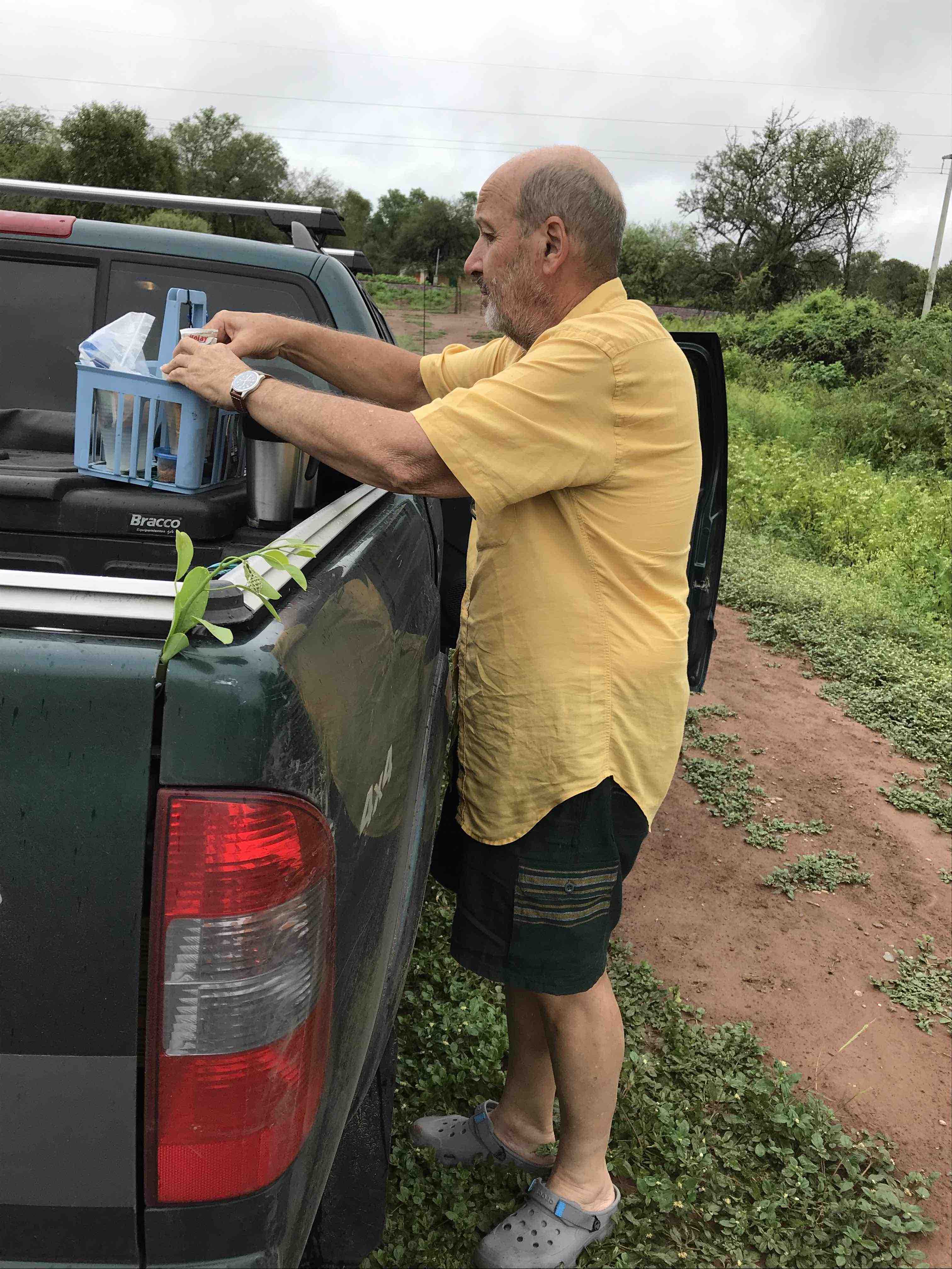
Preparing a coffee and snacks.
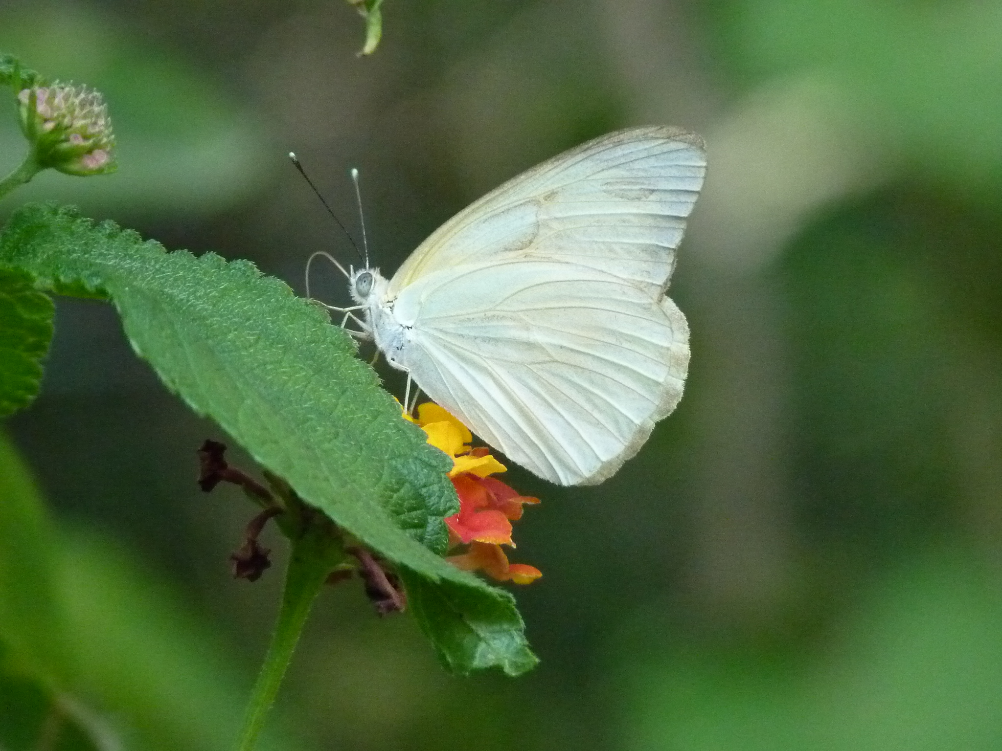
Aware that, after spending time negotiating the bad road drivers tend to go really fast we drove off the road down a gentle slope a few metres towards the railway track that runs parallel to the road most of the way and enjoyed our food while discovering a few interesting inhabitants.
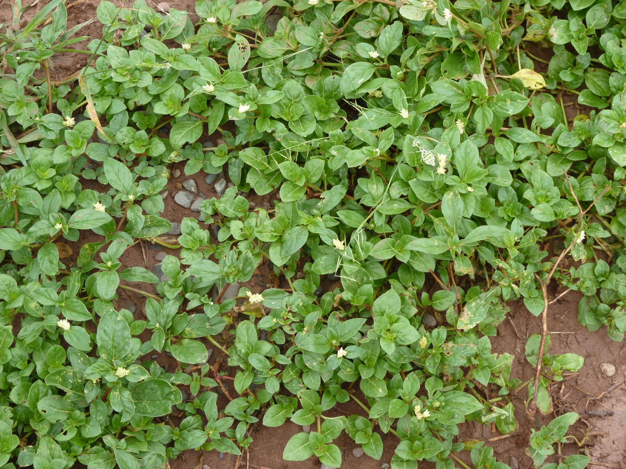
See if you can spot one of the locals… The answer is at the bottom of the post!
When the time to go came we were surprised that the car did not move although the engine was making an effort to go! We got out and discovered that one back wheel was spinning in the hitherto undetected red mud. I engaged 4WD and tried again with no difference. Well, there was a difference as a wheel at the front also buried. Used to these situations, I stopped the car and proceeded to inspect the situation learning that the grass upon which our left wheels were it was very soft and the wheels were deeply set. We were well stuck!
Luckily we carry a few tools for these occasions and the spade came very useful to dig in front of the wheels to enable them to move as their thread was totally filled with sticky mud that did not allow any grip. To make matters more sticky, raindrops were falling and it was imperative that we dug fast. We had about two attempts at going but our rather optimistic digging did not work. Eventually, after quite an effort the car move about one metre. That was all we needed and I rocked it back and forth until it gain some motion forward and, with the engine screaming, Mabel pushing and spreading mud all over, the car moved and I did not stop until I was on high and firm ground. It was a relief as we had lost about two hours between the picnic and the mud!
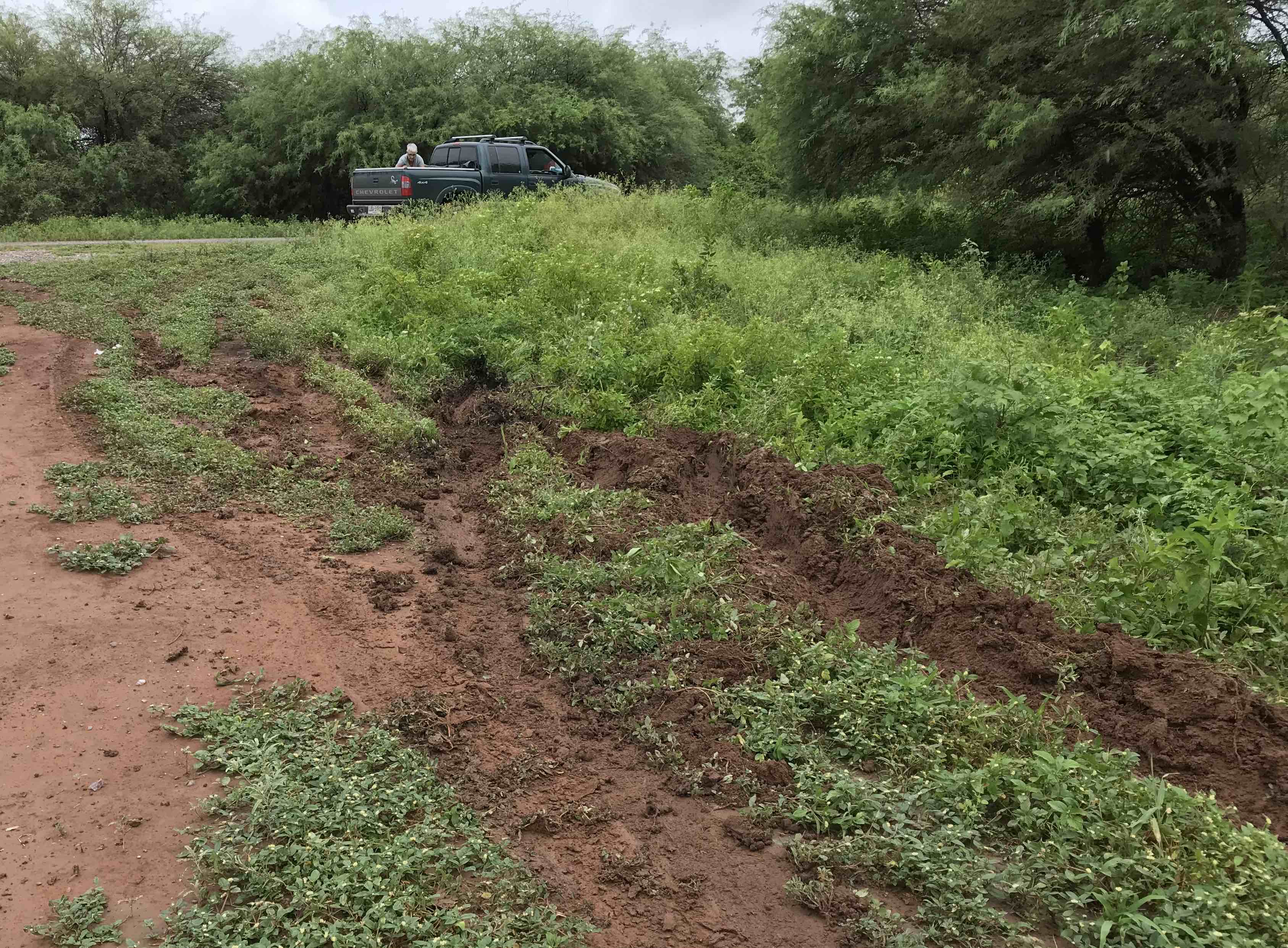
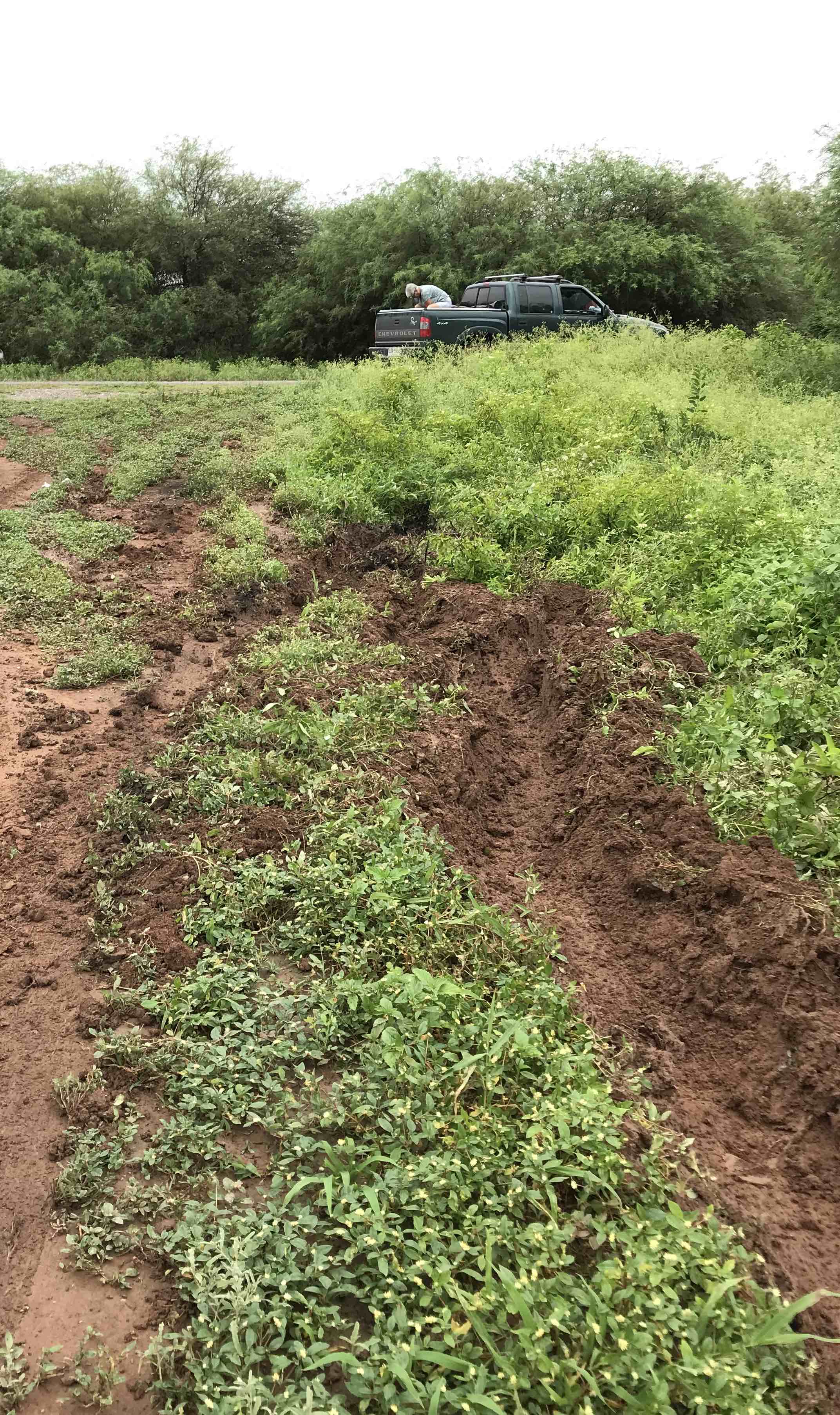
With the car back on the tarmac, we took a picture of the trench we made!
From then on we had no other difficulties and we soon caught sight of the hazy mountains in the distance that are always welcome as they are the sign that we are getting close to the Andean mountains and our destination: Salta La Linda from where I will be writing for the next three to four months.
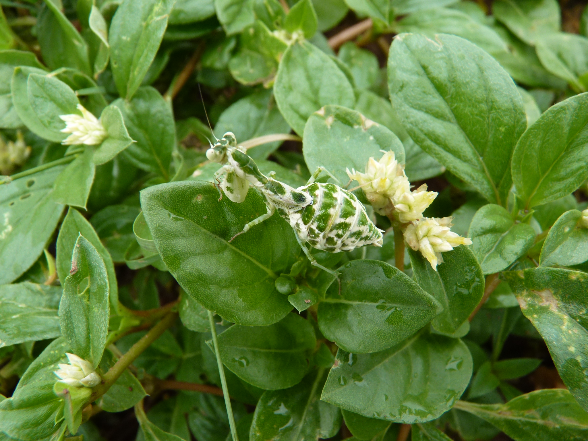
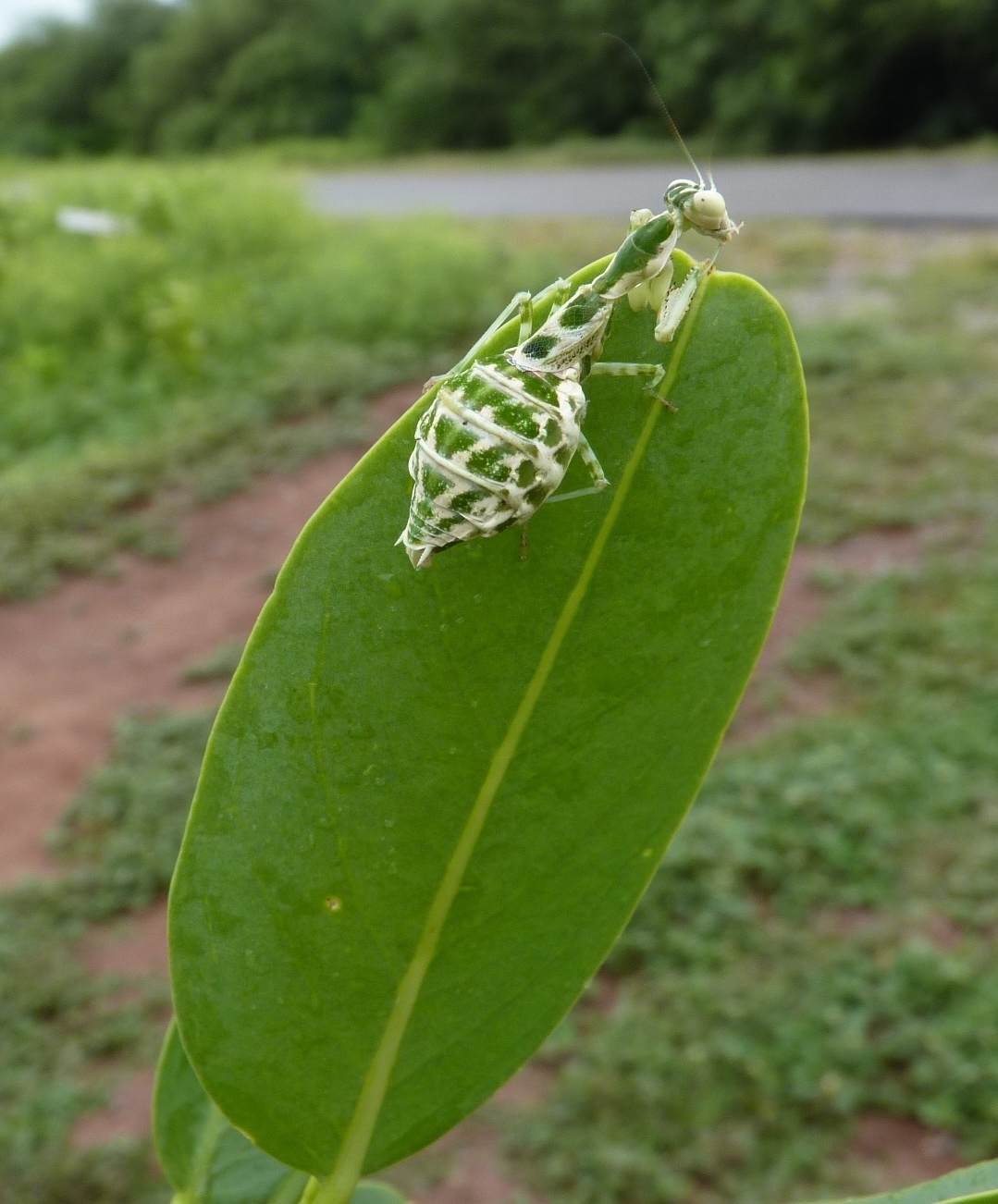
An immature mantis waiting for the right prey to pass by!