Safari

To the cradle of mankind – Getting there

Lake_Turkana_vicinity

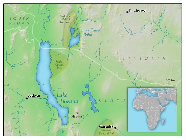
The area we traveled. Attribution: Rudyologist [CC BY-SA 4.0 https://creativecommons.org/licenses/by-sa/4.0)%5D

Day 1 – Nairobi to Maralal

Not intimidated by the amount of stuff packed in and on the cars as well as on the trailer and full of enthusiasm we left Nairobi via Nyahururu with Maralal as our destination for the first night. A drive of over 350 km of which, about half would be done on tarmac, the last good road we would enjoy until our return to Isiolo.

Turkana safari Land Rover PR dust copy

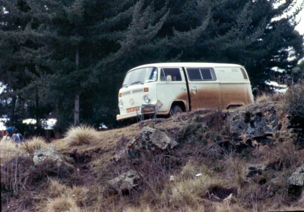
Paul coming with the trailer when things were still going well.

Slowly we left Nairobi and drove along the eastern wall of the rift valley towards the north and soon passed some of the landmarks we knew well, Mt. Longonot and Lake Naivasha. We passed Nakuru and reached Nyahururu from where we headed across the Laikipia plateau towards Rumuruti on a good dirt road. Once we passed the latter, the road narrowed as it started to climb towards the 1,965m of Maralal, unknown territory for us. Our excitement grew and things started to happen!

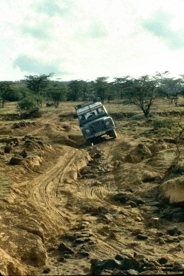
The combination of a heavy trailer being towed uphill in a hot climate started to take its toll and Paul’s Land Rover’s engine started to heat up. When I saw him flashing lights at us we stopped and, after seeing the situation, decided to wait for the car to cool down and then see what to do as we could not see anything obviously wrong. This happened about 30 minutes later and we decided to resume the journey.

After a few kilometres Paul stopped again and it was clear that the problem needed a more radical solution in order to -at least- reach Maralal. We could not lighten the trailer so we decided that we should tow it. Although our car was shorter, it was much newer and we hoped that it would be better able to withstand the effort.

Luckily the car put up with the extra burden and that is how I acquired the responsibility of pulling the rather large trailer all the way not just to Maralal but to Koobi Fora and back to Nairobi, learning on the job! The first thing I quickly got to terms with was that my driving style needed to change if we were to survive! Every time we braked, we could feel the trailer’s inertia pushing us and slow us down by severe jerks when we needed to accelerate. Gradually I got the hand of it and made good progress, all things considered.

Quite late that day we reached Maralal late and we set up camp with the aid of the car lights at the Catholic Mission. It was very cold and through the mist we caught a glimpse of the very old and somehow decaying cedar trees (Juniperus procera). This cedar is known as African pencil cedar, obviously from which pencils can be made. These trees were part of the highland mist forest, indigenous to Maralal mountain.

All the cedars were decorated with Old Man’s Beard or Spanish Moss (Usnea spp.) an epiphyte or plant that grows on another but not as a parasite. The area was renown for been forested by these species but there were not many left, at least around the area we were.

Although leopards were common, we did not see any while we spent a cold night and we were ready to go as soon as we felt strong the following morning.

Day 2 – Under Mt. Kulal

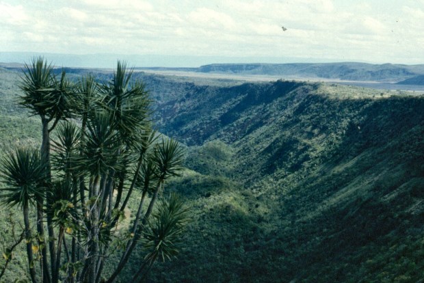
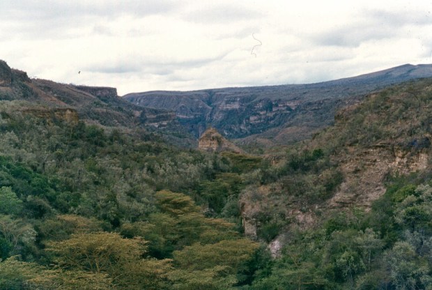
The following day we continued towards the southern shores of the lake. The road went down until we reached flat ground. On the way we turned into a small track sign-posted “World’s View” or a similar name. We were curious to see what it was but soon our curiosity turned into impatience, as the road was endless. We stopped and discussed our situation but decided to go to the bitter end rather than to turn around.

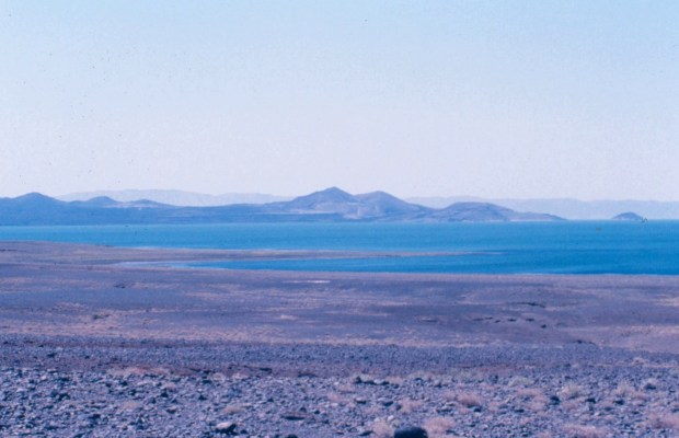
The long drive was worth its length and every shake we experienced not to mention the inhaled dust for, at the end of it, we were contemplating the southern tip of Lake Turkana, bright green against which rather recent volcanic cones were prominent. Southern Island could be seen far off towards the north as well. We were all speechless for a while and I believe that we were far too impressed to take pictures as I could not find any!

Embed from Getty Images

Once we filled our eyes and minds with such an unforgettable view it was time to move on as we still have some kilometres to drive before arriving to our next stop by the shores of the lake. We retraced our route and eventually we got back to the main track, with the image of what we had just seen fresh in our minds.

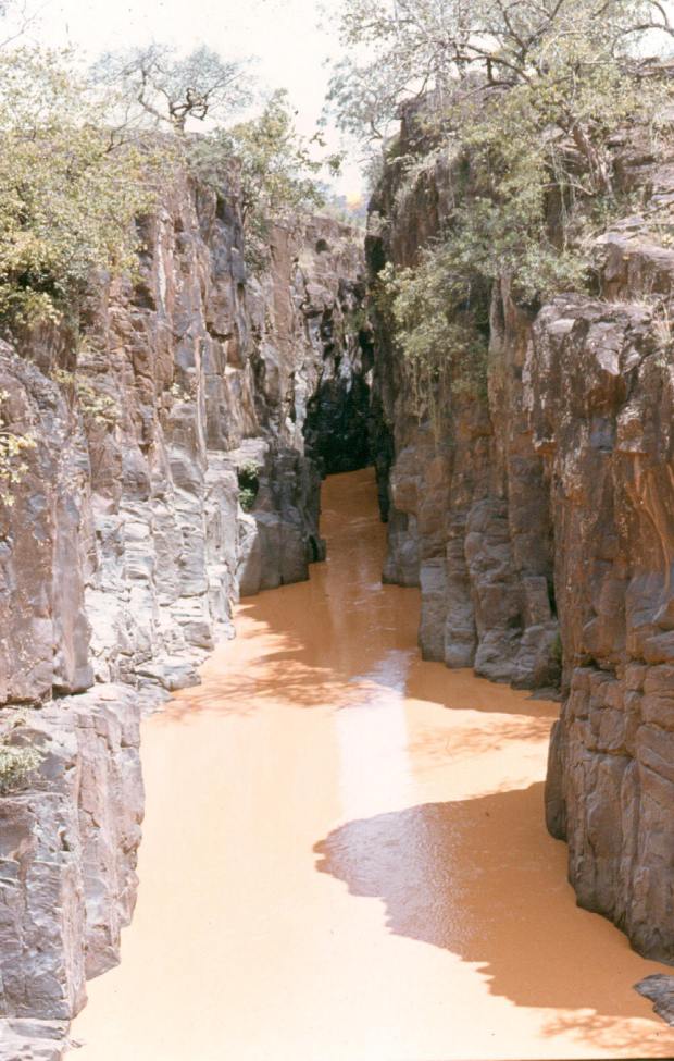
The road turned to rough and sharp volcanic rock while we crawled towards the lake and, somehow, we went over a small hill avoiding large black boulders and we got to the lake. We left its shore on our left and continued on the black track that turned inland through dry bush for quite a distance until we could see a large mountain that we -correctly- assumed to be Mount Kulal.

turkana safari 4

Shade booked by Turkana sheep and goats. No room for us!

turkana safari gravy zebra

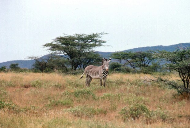
A Grevy zebra, a “special” of Northern Kenya.

With its 2,300m Mount Kulal dominated the landscape and we could just see its two peaks but in order to see its evergreen forest where cedar trees and lammergeyers are supposed to be found we needed a much closer approach that was not part of our itinerary.

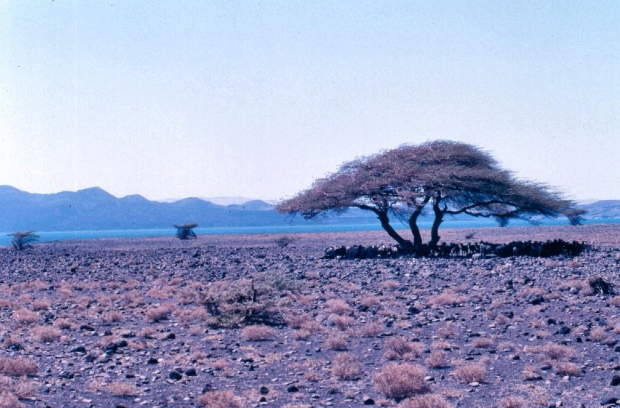
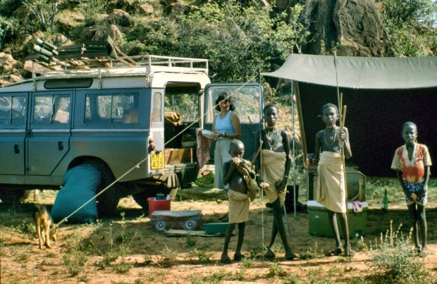
Eventually the track turned left towards the lake and, again, we got to its shores in mid afternoon. We were still south from Loyangalani and there were sandy beaches. Tired we stopped to contemplate the lake and soon a group of Turkana came to greet us and to watch us from a distance. It was very hot so we had a quick swim -after checking for crocs- and then started preparing our camp.

It seemed that Mt. Kulal acted as bellows blowing very hot air towards the lake but we were prepared to protect ourselves from it. Or so we thought… As rehearsed in Nairobi our cars were parked parallel to the lake at about 10m from each other and then, once the tarpaulin was dug up from the depths of the trailer, we proceeded to assemble it.

We immediately realized the difference between setting it up in windless Nairobi as compared with the true hot gale coming from Mt. Kulal. After quite an effort from all five of us, we managed to tied it to the two vehicles and create a shelter although the wind was still passing under it and through the sides. I am sure the Turkana members of the public watching us had a good laugh about the antics of the bunch of “mzungu” [1] trying to get blown away into the lake instead of settling down!

We soon realized that we could not achieve the expected results and, as light was fading, with our pathetic wind breaker flapping loudly and constantly, we proceeded to organize our camp. However, after a few minutes we heard a ripping noise and our tarpaulin became a gigantic green flag flapping in the wind, held to only one of the cars.

We decided to untie it before it flew into the lake and drove the cars together across the wind and use them as a shelter. I am sure the Turkana visitors approved of that! Unfortunately camping was still difficult and, at some stage, following a particularly strong wind attack, all our light stuff including chairs and clothes flew off towards the lake, followed behind by our complete fire together with our pans, including their contents!

turkana safari camping kulal area 2

After the struggle, the tarpaulin became our floor!

In view of the crisis, we had a tinned dinner and did not bother to put tents up but slept under the stars behind our cars putting up with the occasional gust of wind as it was a hot night. I still remember that I had difficulties to go to sleep as my hair (quite long then) kept hitting me on the face and eventually I needed to wear a cap to be able to stop it from bothering me! After that I managed some sleep.

Day 3 – Dry river-bed in Sibiloi National Park

Luckily, the following morning was windless and we could enjoy a very needed English breakfast. After short walks in the beach it was time to move on to cover the approximate 200 kilometers we had plan for the day.

We drove north and, somewhere after Loyangalani while driving close to the lake, we encountered a solitary mzungu walking in the opposite direction. He stopped us. He was a young man with severe sunburnt that just managed to ask for water despite his mouth being very dry and his tongue rather swollen. We gave him some of our water and filled his water bottle and, as soon as he got the water, without saying a word, he just walked off, ignoring our offers for help!

Still thinking about what this lone walker would have been doing there, we followed the road that at this point moved inland and then run parallel to the lake. After quite a long drive we go to the entrance of the Sibiloi National Park, created in 1973 for the protection of paleontology sites and wildlife. It is 1,570 km2 of semi-desert habitat and plains bordered by volcanic hills, including Mount Sibiloi.

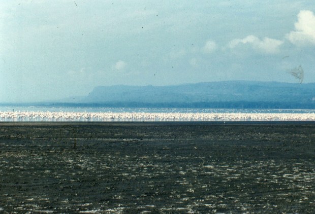
Migrant waterfowl stop here and many of the more than 350 species of aquatic and terrestrial birds found at Lake Turkana can be spotted here together with zebras, Grant gazelles, lions, leopards, striped hyenas, Beisa Oryx, greater kudu, cheetahs and northern topi. Sibiloi is also a crocodile breeding area and the Turkana, the Gabra and the Dassanach ethnic groups surround it.

turkana safari 1 2

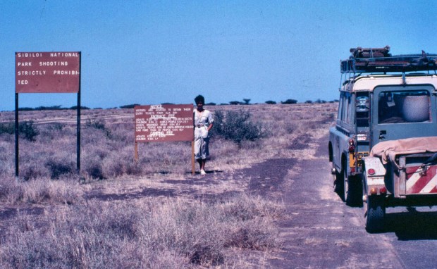
Mabel at the entrance of the Sibiloi National Park.

After entering the park we stopped briefly to look at the rests of a petrified forest and, in the afternoon, we got to a dry river bed where we decided to go against the manual and risk the unlikely flush flood camping there on it as it offered a nice and soft sandy bottom, quite a change from our rocky and thorny surroundings and, most importantly, it offered a pleasant windless environment!

There we spent a rather pleasant night, again under the stars, as the temperature was still hot. The following morning, after another excellent breakfast, we broke camp and left for the next few kilometres that remained before getting to Koobi Fora.


[1] A term used in Kenya to refer to white people.


To the cradle of mankind – Background and preparations

Koobi Fora takes its name from a ridge located on the eastern shore of Lake Turkana in the territory of the nomadic Gabbra people and within the Sibiloi National Park. In Gabbra, Koobi Fora means a place of the commiphora and the source of myrrh [1].

The ridge contains mainly Pliocene/Pleistocene sediments (clay, silt and sand stones) that have conserved fossils of terrestrial mammals, including early hominid species.

In 1967 Richard Leakey’s flight to the Omo region the pilot flew over lake Turkana to avoid a thunderstorm. Although he expected the Koobi Fora area to be volcanic rock, he spotted sediments and later, during another visit by land, he saw tools and fossils that led him to establish the Koobi Fora Base Camp on a large sand spit projecting into the lake near the ridge.

Lake_turkana Credit NASA

Lake turkana in Northern Kenya from a satellite. Credit: NASA.

In 1969 Leakey’s team found a cranium of Paranthropus boisei that created great enthusiasm. Three years later the skull of Homo rudolfensis (KNM ER 1470) was uncovered and after another three years a Homo erectus skull was found. (KNM ER 3733) and a second -intact- one in 1978 (KNM ER 3883). Leakey wrote a number of books on the subject of the evolution of man that made him world famous [2].

Leakey’s books were very popular at the time we were in Kenya and reading them was probably what hatched the idea of a safari to the area to see where the fossils had been found as an excuse to explore the area of lake Turkana, immortalized in the book “Journey to the Jade Sea” [3].

Lake Turkana, a brackish soda lake, is found in Northern Kenya where its 48 km of width, extends for 256 km from north to south in the border with Ethiopia. Volcanoes surround the green lake. Some like Nabiyotum Crater in Southern island are truly beautiful but there are several in the southern part of the lake where the Kerio and Turkwel Rivers enter it with fresh water.

turkana safari 5

Some of the beautiful volcanic cones at the lake.

The lava flows surrounding the lake are often too hot to touch, the winds blow with gale force and the beautifully green lake was home to nomadic ethnic groups such as the Turkana and El Molo and it also offered -apparently- good fishing as well as a very large population of very large crocodiles!

We knew that the lake was rich in crocodiles (estimated at 22 thousand), fish, bird life and scenery, particularly its stark volcanic hills and still rather untouched by “civilization” so that Turkana fishermen did not need clothes! Count Teleki “discovered” it in 1888 describing it as with “beautiful water… clear as crystal…” but the name he chose, Lake Rudolf, is no longer in use.

The lake offered, therefore, a number of interesting challenges that we could not resist. Three factors influenced our decision, two were related to our friend Paul who, at the time was befriending Else, a lady working at the National Museums of Kenya and the visit of his brother from the UK. Through Else we got the green light to visit Koobi Fora so, the preparations for the trip could begin.

The third concerned to both Paul and I and it was the apparently amazing fishing that you could have in Lake Turkana as no one knew why Nile Perch there reached 90kg and over and the tiger fish fought so much!

We agreed that we would travel in tour two Land Rovers but when we estimated the amount of food, water and gear we would need, we despaired, as, although both cars had roof carriers, they would be too overloaded to withstand the expected rough journey. We were stuck!

However, Paul found a solution in the shape of a disused trailer that was at Muguga that he could use and that, importantly, it had the same tires than our cars. It was a long metal contraption looking (and being!) very heavy but it was our only option so we took it from the yard where old cars were kept for a sale that never took place, and towed to Paul’s house, our temporary centre of operations.

The journey would take several days and the planned itinerary would take us through Maralal, South Horr. Loyangalani, North Horr, Koobi Fora, Chalbi desert, Marsabit, Samburu and, finally, Nairobi

We were fortunate that Paul had a small gas fridge that would enable us to carry some perishable food for a few days although we added, apart from the normal cool boxes with normal ice packs, one with dry ice to be opened after a few days during the journey.

Mabel and Else developed the menus and food and they got involved in careful calculations so that we had enough eggs and bacon, cooking oil and fresh and preserved fruits as we were not sure of how much we could get on the way.

Luckily Mabel had by then accumulated good camping experience and we relied on her to do the planning. As time was very long and the area very hot, she decided to place our “last” fresh stuff in the dry ice cool box to be opened on day five. After these final supplies were over, it would be tinned food.

Apart from having the Land Rovers in the best condition possible according to their ages, Paul and I dealt with fuel and other car essentials as well as the necessary camping and fishing gear. We prepared our tents, sleeping gear, camping chairs and tables, making sure that all necessary bits and pieces were there, including mallets and spades as well as some charcoal for the areas where no firewood was obtainable.

The safari stuff mountain grew by the day and the inclusion of the fishing gear did not help. As this was considered as one of the highlights of the trip the rubber dinghy was added, together with engine and petrol. Aware that the lake harboured large fish such as Nile Perch and Tiger fish we took heavy fishing gear, hoping that it would be enough for the expected fish fights.

We also needed to carry sufficient water and fuel. Although we would be able to find both on the way, we settled for 80 litres of petrol. As far as water was concerned we only took 40 litres as the water of the lake was considered as mildly alkaline and drinkable in an emergency.

We took four spare wheels, as we could share them and we also collected what we thought was a rather comprehensive set of tools and a rather large assortment of essential spares that included everything we thought our cars might need during the estimated 3,200 km of the return journey, without counting local travel.

Security reports were essential before venturing into this area and we learnt that it was good at the time although the occasional incursions by bandits known as “Shiftas” could not be predicted. We decided that this was good enough and decided to risk it.

The final moment of truth came when Else got the permit to enter into the Koobi Fora area and use the accommodation that had been built there by Richard Leakey and the National Museums of Kenya. We had then, like Julio Caesar, crossed the Rubicon and there was no way back!

However, there was one more step before we were ready to go. We knew, from the experience of other visitors, that we should expect very strong winds, particularly in the vicinity of Mt. Kulal, the mountain of the winds! We decided that we needed a barrier and we borrowed a rather large and heavy lorry tarpaulin that we intended to use as a wind barrier by tying it between the two cars.

So, the Friday before our departure we decided to have a “Windbreak setting up rehearsal and dinner party” that had more of a party than a rehersal for the setting up of the tarpaulin!

However, afterwards, we felt we could handle the voyage.


[1] See: https://www.museums.or.ke/koobi-fora/ consulted on 21/11/19. My addition: Commiphora, is the most species-rich genus of flowering plants in the frankincense and myrrh family,

[2] Origins (with Roger Lewin) (Dutton, 1977); People of the Lake: Mankind and its Beginnings (with Roger Lewin) (Anchor Press/Doubleday, 1978) and Making of Mankind (Penguin USA, 1981) among others.

[3] Hillaby, J. (1973), Journey to the Jade Sea. Academy Chicago Publishers. 206 p.


Wamba sweet tea

It was Paul’s idea to do what he called the Wamba circuit that was really a long drive passing through Wamba town to an area in the bush where we would find a suitable spot to camp and enjoy the vastness of the area, together with its wildlife.

The detail of how we got there escape me now but it was a very long drive from Nairobi past Isiolo and following the road to Marsabit National Park, turning west at Archer’s post on the way to Baragoi and, a while later we got to Wamba, a small town in Samburu County in central Kenya, located to the southwest of the Mathews Range, and northwest of the Samburu National Reserve.

We were thirsty when we got to Wamba and looked for a place where we could get a cold drink as we needed to fix some mechanical issues with the Land Rover. After driving through the town’s dusty roads under the late morning heat we found a place that had fridges and we went in hoping for a cold beer or, if not, even a cold soda could have done! The attendant took the order and came back with the drinks that were at about 40oC as there was no electricity and, as it is common in Africa, the fridges are used as cupboards! We were devastated and refused to drink them!

The waiter then offered us spiced tea and we accepted as at least it was meant to be a hot drink and it was water after all. What came, served in glasses, was probably the best cup of tea that I have ever drunk, an impression probably aided by the circumstances. It was very sweet and it tasted of true clove, cardamom and cinnamon. We drank lots of it and thanked (and tipped) the waiter for such a great tea and we were ready to go.

We drove on through a vast dry and extremely hot area with scattered rocky outcrops. As we had the whole area to ourselves, we chose one of the few places with some sizeable trees for shade and also with our “own” kopje that would also provide some additional shade, we estimated.

Camping Wamba trip with PR copy 2

“Aerial view” of our camp.

There we assembled our camp that consisted of the tents and a makeshift shade added to the Land Rover, as we were not planning to drive but to walk. As usual in these places, although one believes to be alone, this is far from true and about thirty minutes after we arrived we already had a “guard” of young Samburu boys standing by our camp with who we were, unfortunately, unable to communicate apart from offering them water and food! They came from an unseen manyatta nearby and they seemed happy to stay with us until just before sunset.

Camping Wamba trip with PR 1 copy 2

Mabel under custody!

The following morning we decided to have “an English breakfast with a view” and, not without some difficulty, carried our fried and scrambled eggs, bacon, sausage, mushrooms, fried tomatoes, toasts and butter! In addition we carried our thermoses of coffee and tea up “our” hill. Being hot helped to keep our food warm by the time we reached the top and we started eating once we found places to sit.

wamba trip

“Our” rocky outcrop with Paul at the top.

We had the most magnificent view of the immense bush country extending in all directions below us. After a few attempts, I managed a picture of the three of us with our breakfast that placed us, I am sure, among the early pioneers of the present day selfies!

We were about our second bite when a mighty blast made the kopje shiver and almost took the plates from our hands! Truly shell-shocked we all looked to see if the car had blown up but, luckily, it was still there although our Samburu guards were nowhere to be seen.

Then, we saw a column of dust and smoke about five hundred metres from us and, then another explosion and yet another! Still on the kopje we checked with the binoculars and saw that the bushes were moving! Incredulous, we looked again and realized that camouflaged tanks and other army vehicles were coming through the bush towards us!

wamba trip 2

The selfie before breakfast. The troop movement started later in the bush at the back.

Our first thought was that Somalia was invading Kenya and we went into a mild panic as the thought of being among the first prisoners of war did not appeal to us. However, as this would be unlikely, we decided to come down from our lookout and finish our now cold breakfast at camp to wait for developments with “a stiff upper lip” as were clearly outnumbered!

We did not have to wait long before a Kenya army Land Rover with soldiers in full combat gear arrived. Clearly they were surprised to find us there but they immediately realized that we were just campers, if a bit out of the ordinary for having chosen that particular area for our holiday!

They politely explained to us that we happened to be in an area that was used for joint Kenya-British army maneuvers and they just wanted to inform us of the situation and tell us that we could stay the night but it would be better for us to vacate the area next day as some live ammo was being used!

We stayed for the rest of the day surrounded by army trucks and infantry marches until it was time to leave, obviously, without having seen much of the area!

We returned to Nairobi through Rumuruti, Nyahururu and Nakuru and later we learnt that the land we camped in belonged to the Kenyan government and it had been used for military training by the Kenya Defence Forces and the British Army for many years.

Spanning the Kerio river

In the lake Baringo area the Kerio, one of the longest rivers in Kenya, coming from the Amasya Hills (on the equator) and west of lake Bogoria, flows towards the north through the fertile Kerio valley between the Tugen Hills and the Elgeyo Escarpment. It continues its way to the north through semi-arid country where it has carved narrow valleys, some very deep. Then, it enters in the southern end of lake Turkana. Together with the Turkwel river it contributes to almost all the river water that flows into lake Turkana.

The information we got was that one of the gorges known as the Cheploch gorge was so narrow that it could have a leg on each side while watching the river gushing through on its way to lake Turkana! We thought that it was a good reason to explore an area we did not yet know.

So, once we were in lake Baringo, we extended our trip and drove about through Marigat and Kabernet to reach the “famous” gorge. Marigat, our first populated area after about 20 km was then a small and dusty town inhabited by people from the Tugen, Njemps and Pokot communities who are mainly pastoralists. We passed it and went on to Kabarnet, 40 km further on where, despite sounding like a wine-producing area, we did not see any vines, unless they used papayas for the brew!

It was in the road from Kabarnet to Iten that the Cheploch gorge was found, just after the village of Ainamoj where the road crossed the river. The river had really carved a very deep gorge, estimated at 70m deep and very narrow, but not narrow enough to span it and even if it would have been, looking down at the river’s strength, I would have declined the offer!

kerio valley kerio river

The gorge at the time of our visit. Looking at the picture today, I thought I could have spanned it!

However, the gorge was indeed amazing and the trip worthwhile as it took us to one of the “secret” areas of Kenya at the time.

While writing this post I learnt that, after our departure, an “industry” had developed by local people not to help you to span the river but of divers offering to jump from the edge of the gorge for a fee!

A rather different seen today!

Although in 2016 the Government stopped this activity after one of the divers died [1], it resumed a while later and it is still taking place as there are videos dated May 2019 that show the jumpers in action as there are visitors that continue to pay to see people risking their lives!


[1] See: https://allafrica.com/stories/201601190899.html Accessed 21/11/19.


Safari Rally

Soon after our arrival we heard about the Safari Rally, one of the yearly attractions that Kenya had to offer and that had been going since 1953 as the East African Safari Rally and as the Safari Rally from 1974, a few years before the breaking up of the East African Community.

Although we could not watch the race on our arrival in 1981 we learnt that the Kenyans Shekhar Mehta and Mike Doughty won it. The pair seemed unbeatable, as they had already won in 1979 and 1980.

By 1982 we had our car and we decided to follow the rally with daily trips to a couple of places near Nairobi as well as watch the cars arrive in Nairobi at the end of the rally. We studied the route of the three stages and selected areas near Kajiado and in the Kinangop plateau.

Without experience on watching races of this kind, we thought it wise to leave early to find a good and safe spot. We also carried our safari chairs and food and water to last us for the whole day. The rally was held when the long rains were meant to begin so you either had a dry or a wet rally. It was dry that year so our concern with potential mud traps did not came up until in later editions!

We learned a few things about the rally that first time. Seeking some excitement we searched for a place where we could see the cars coming from far and that, close by, would offer a bend or a culvert that they needed to do some exciting turning or a nice jump.

n kinangop safari rally kombi

A good and safe vantage point to watch the rally.

As we were in the selected area early, we had sufficient time to drive for a while until we perched on a high slope that offered a great view where we set up our camp and waited. Gradually the place started to fill up with other visitors in cars but also of people on foot coming from the surrounding areas. The latter really enjoyed seeing and hearing the powerful cars driving past as, in those areas there was no much traffic otherwise. I was also amazed that there were no accidents as people, unaware of the danger, placed themselves in large numbers in exposed spots, very close to the cars!

We waited for a couple of hours and then the crowd -quite a sizeable one by then- started to stir and soon we could also see the dust plume far away. The first car was coming so I prepared myself to take my first “speed priority” shot at a fast moving car from a good spot, near the road.

As the dust got close we could actually see the numerous and very strong lights that they carried and I had no doubt that the car coming was from the rally so I shot and got covered in dust at the same time! To add insult to injury, after the event I realized that it was a support car! Another lesson learnt: support cars look just like the real ones minus a number on the door!

1982 saf rally altonen opel

The dust of Altonen’s support car!

Eventually we watched the “real thing” or rather the first one of the race because, after the first car drove past, a succession followed in hot pursuit and the dust cloud got fed by each one of them and spectators’ visibility was severely reduced. I could not believe how the drivers could see the road, leaving alone trying to overtake! I took some poor pictures. Luckily, once the aces past, gaps between cars increased while speed decreased so we could actually see some of the cars!

Once most of the cars passed we could initiate our return home. We thought we had breathed and eaten dust but there was much more to come while driving home among a convoy of motorists doing the same. There were still some of the slowest cars coming and this added an extra touch of adventure to our trip.

Finally, the duo Mehta-Doughty won for a fourth time that year but our hearts were with Robert Collinge and Mike Fraser that were racing in a “normal” Range Rover! After a gallant race where they had all sorts of problems (I believe they hit a cow and lost their bonnet) but still they managed to arrive in 6th. place, a great achievement, still remembered in rally circles.

1982 north kinangop safari rally collinge's r rover

The Collinge and Fraser’s Range Rover minus bonet going for the finish line.

Apart from the big rally teams, individual entries were also present and they relied on friends for repairs and to bring fuel and spares to strategic places in order to continue with the race! For those private participants just to arrive was a great achievement and we witnessed scenes charged with emotion when the crew of a private participant embraced celebrating their arrival at the end of the third stage, regardless of the position, with true sport spirit.

We did follow the rally in subsequent years but nothing compared to the first one in 1982 and we eventually stopped but not before having a test of a wet rally in 1985 where things dramatically changed as cars did not cover you in dust but in mud and water! A video below illustrates the point.

Credit: vipersan1 from Youtube.

During that rally we also learnt that it was one thing to drive through a muddy road before the cars passed and another very different and frustrating to try and return home with our kombi VW. We got stuck a few times! Things were not made any easier when some clever Kenyans started to “improve” existing potholes both lengthwise and in depth so that, once you fell in “their” mud trap, they would push you out for a small fee! African entrepreneurship at its best!


Windsurfing with hippos

As you will learn later, I took up windsurfing during our holidays at the Kenyan coast but I never got beyond the beginner’s level, basically due to lack of practice.

There are two fresh water lakes in the Kenya Rift Valley, Naivasha and Baringo. The former is a weekend destination for many people in Nairobi that we use to call “water babies”. The lake was not a reserve and it was open to people to sail and fish at will while staying in the various luxury hotels spread along its shores [1].

Lake Baringo is much further away to the dry north and to get there requires quite an effort and it is not really suitable for a weekend break. We visited it sometimes as a stopover when heading for other destinations and perhaps twice as our final destination.

Lake Baringo has an area of 130 square kilometres and the Molo, Perkerra and Ol Arabel Rivers are the rivers that feed it. It has no known outlet but it is believed that its water seeps through the bottom into some underground current where it finds an impermeable layer. There are over 470 species of birds there, occasionally including migrating greater flamingos as well as a Goliath heronry located on a rocky islet known as Gibraltar that is an amazing sight!

baringo island camp

Island camp.

The lake was believed to bee free from Schistosoma parasites and also that its crocodilian inhabitants, because they were not disturbed, also did not bothered swimmers and sailors. The hippos, however, were “normal” and it was advised to give them a wide berth, as there were quite a number, particularly near the shores. Despite this potential danger the local Njemps fishermen moved about the lake in tiny boats and rowed with some special paddles that they fitted in their hands!

baringo best

Young Njemp rowing in the lake.

We always camped at Robert’s Camp and we spent time walking and driving around the lake in search of some of the rare birds that were present there. One occasion we shared the camp with some colleagues from Muguga that were keen on sailing and they had also brought their windsurfing gear.

They insisted that I borrowed it to have a go. I put forward the excuse of the low temperature of the water trying not to mention my concern for the hippos and, to a lesser extent, the crocs but they insisted.

I had seen the abundant hippos present at the lake and pointed this out to them but they convinced me that, as far as they knew, there had never been an accident with either hippos or crocs. Seeking consolation in the way the Njemps fishermen move around the lake, I thought that the windsurfing table must have been at least twice the size of their boats and, therefore offer more protection in case of an attack.

So I bit the bullet and ventured into the lake! It all went well starting in the open water, far from the shore and eventually my friends, seeing that I would manage on my own, went on sailing, faster than me and soon I was forgotten by all!

JC windsurfing from slides 1 copy

Preparing to start.

After about an hour of sport, not being really used to it, I got tired and decided to head back to our camp. This meant coming closer to shore where the hippos were! Luckily I managed to sail in the right direction and eventually I got within a short distance from our camp. Now I needed to get there! This was easier said than done.

Between me and the camp there was a shallower area that could only be negotiated through a narrow canal and there, in the middle of it, a pod of hippos were doing whatever hippos do when they are inside the water as a family!

I was in a tight spot and quite concerned! I decided to do an exploratory approach to the beasts to see how they would react to my presence and then stop. I did so at about twenty metres from them and they replied with some grunting but nothing else happened. I took this as a half-hearted warning to the semi-naked human that was approaching them.

The situation was becoming tricky but in what I now regard as a foolish (but rather courageous) move, decided to go for it and gathered speed, trying to keep to the side of the channel where I saw no hippos.

Although I thought I was going fast, I am sure I would have been dead meat if the hippos wished to go for me. Luckily, they only watched me pass and snubbed me by showing me their fat rear ends! Eventually I managed to hit the coast at full speed and felt very relieved.

JC windsurfing from negatives 1 copy

Going for it.

When my colleagues returned to collect the table I was already relaxed and kept the incident of the hippos to myself.

baringo

Evening at lake Baringo.

[1] See: https://bushsnob.com/2019/11/23/lake-naivasha/

Mount Kenya

mt kenya 2

Mt. Kenya (5,200m), the second highest mountain in Africa after Mt. Kilimanjaro (5,900m) could be seen from some parts of the Muguga road on a very clear day as if inviting us for a visit. It was a rugged mountain with snow and three main peaks: Batian (5,199m), Nelion (5,188m) and Lenana (4,985m). They are named after Mbatian (a Maasai Medicine Man), Nelieng, his brother, and Lenana, one his sons.

mt kenya way to shaba 1

In 1849 Krapf found the mountain, located a few km south of the equator, following a similar story of the finding of Kilimanjaro described earlier. It was Krapf who gave the mountain the name “Kenya”, likely to derive from the words KirinyagaKirenyaa and Kiinyaa which mean “God’s resting place” in the language of three of the main ethnic groups that live around the mountain: Kikuyu, Embu and Kamba respectively. The mountain gave the country its name.

mt kenya best

Mount Kenya surged approximately three million years after the formation of the East African rift valley and it has suffered the impact of erosion resulting in what we see today: weather-beaten slopes, valleys and shrinking glaciers. Mount Kenya is the main water catchment area for two large rivers in Kenya: the Tana, the largest Kenyan river and the Ewaso Nyiro than runs north through very dry country.

The vegetation in Mt. Kenya changes with altitude. Around the base of the mountain we saw fertile farmland extending as far as you could see and I recall the amazing horticultural wealth of the Murang’a market where, among an enormous amount of horticultural produce, I have seen the largest cabbages! Unfortunately, althogh necessary, it was clear that the agriculture frontier was gradually encroaching the forests.

This slideshow requires JavaScript.

The nature of the forests found in Mt. Kenya depend on rainfall and whether they grow in the south- or north-facing slopes. Above the forest there is a wide band of almost pure bamboo and above it we find the timberline forest with smaller trees. The heathland (wet) and chaparral (dry) zones start at about three thousand metres. The former, located in the wetter part has giant heathers while the latter is found in the drier areas and it consists mainly of grasses.

As we continue our virtual climb, the temperature fluctuations increase to extremes and the air’s oxygen decreases and we enter into the most known place of the mountain: the Afro-alpine zone, an area with several endemic plant species such as giant groundsels (senecios) and giant lobelias. After this there are glaciers and rock in the areas that the latter had retreated and no vegetation is present there.

Not being climbers or hikers we had a limited interest in mountains and preferred to spend our time in the more manageable lower grasslands of Kenya. However, we decided to give it go.

During our first visit to Mt. Kenya we entered through the west of the mountain, through the Naro Moru gate, one of the busiest. Although we intended to camp near the gate, we decided to go up the mountain on a exploratory trip through a road that got progressively worse until we reached a point where the kombi’s torque and the altitude became even and there we stopped. It was already late so we decided to spend the night in the car, cold and wet, not appreciating the beauty of the place.

meru mt kenya lodge walking

Icy stream.

The following day we managed to turn the car around in the mud and descended to more manageable roads where we had some joy by watching the vegetation and views of the peaks that, luckily, were uncovered that day. We returned to Nairobi and we promised ourselves to come back.

We did return another year. This time we followed a different route on the eastern side through the Chogoria gate that led to our bungalow at the Meru Mt. Kenya Lodge. It was freezing but luckily there was hot water although the firewood was wet and to make a fire was quite a job. It soon became misty and we could not see anything around us, apart from the buffaloes that apparently found the bungalows a protection against predators!

meru mt kenya lodge getting there 1

Avoiding a tree recently pulled down by elephants on the way to Mt. Kenya.

The following morning the buffaloes had gone and the mist lifted so we decided to go for a guided hike to Lake Ellis and suffered the effects of altitude and cold. This was the country where “Icy Mike” an elephant that lived (and died) at 4,400m, an unusual event as it demands very high energy consumption, not typical of elephants and that is still unexplained.

meru mt kenya lodge lake ellis

Lake Ellis.

Like the first, the second visit was not a great success and it was the end of our attempts at ‘enjoying’ the mountain. We left early and got to Nairobi in time to go to the Fox Drive In cinema to enjoy a good movie and an Indian dinner and, later, a hot shower and a rest. We decided that we had done enough and that from then on we would watch Mt. Kenya from a distance and enjoy it!


Lake Nakuru [1]

Being 160 km from Nairobi made Lake Nakuru a favourite weekend escapade as it was well known for its prolific bird life. Unfortunately but at the same time inevitable, the strongly alkaline 62 km2 lake was an island inside farmland and its borders were clearly under pressure from the rural dwellers next door as well as from the town of Nakuru looming nearby and threatening this true bird paradise with its effluent. However, at the time of our visits the park offered unique birding opportunities.

nakuru 1-- 13 6 82

A view of the lake from one of the viewpoints.

The explanation of why there are soda lakes is geological. Rift valley volcanoes spewed alkaline ashes rich in sodium carbonate that the rainwater carried to the lakes. Those without drainage allowed the sodium to accumulate and the water became alkaline. All alkaline lakes are near a volcano: Lake Natron (Tanzania) and Lake Magadi (Kenya) are near Shombole and Olorgesailie respectively, lake Elmenteita near Eburu crater, lake Nakuru near Menengai crater and lake Bogoria near the Laikipia volcanic escarpment.


nakuru 01

Approaching the lake shore.

Lake Nakuru National Park, including the lake itself, has 188 km2 and it was created to protect the soda lake that gives it its name and that lies in the center of the Rift Valley following the arrival of more than 1.5 million of flamingos to the lake in 1960. In 1961 the famous American bird artist and author Roger Tory Peterson called the massed flamingos on the lake “the world’s greatest ornithological spectacle” and this prompted the authorities to declare it a National Park in 1963, mainly as a bird sanctuary.

Clearly the flamingoes, both the lesser flamingoes (Phoenicoparrus minor) and the greater ones (Phoenicopterus roseus) were still the main attraction at the time of our visits and they alone justified the trip although the park had an amazing bird wealth as well as several interesting mammal and plant species. The lesser flamingo, by far the most numerous, had dark pink plumage as well as a magenta beak with a black tip. The greater flamingo was larger and had a pink bill and a whitish-pink plumage.

nakuru 13 6 82 mabel

Mabel watching the flamingoes.

From afar and from the various viewpoints that surrounded the lake they could be seen as a wide pink ring enclosing the lake’s water and flying over the water continuously changing positions. Approaching the shore the ring would start vibrating and soon transformed itself in tens of thousands of birds feeding, displaying, fighting, taking-off, landing, being attacked by predators from both land (baboons and hyenas) and air (birds of prey of all sorts).

Flamingoes Nakuru copy

Lesser flamingoes.

Surprisingly the two flamingo species do not breed in Nakuru and they are only there to feed, their numbers largely determined by food availability and this, in turn, depends chiefly on rainfall. If conditions are not right they move to other rift valley lakes, notably Bogoria.

The lesser flamingoes feed almost exclusively on the free-floating algae that grow only in alkaline water. These algae, known as Spirulina, had grown over thousands of years and the millions of flamingoes that feed on them are the final result. With their heads upside-down, their tongues pump the water that gets filtered in their specially modified spongy beaks trapping the algae. To thrive they need about 150g of food per day, that had been calculated to be a total of 150 metric tons per day to feed the more than a million birds that constituted the Kenya bird colony!

The greater flamingo, much less numerous, fed on shrimps and small fishes and they were present in most lakes, including sometimes in the freshwater ones.

For some visitors the lake was as beautiful as treacherous. The road around the lake was an innocent looking track made of volcanic ash and soda that, although it was dry, it was in fact very soft and muddy below. Some motorists ignored the warning signs and their car wheels would break through the thin crust and sink. They would then find themselves helplessly buried in soft and sticky ash and it was not unusual to find abandoned cars waiting for the park authorities to be able to enter with a tractor to recover them!

Although we admired the flamingoes, the great white pelicans (Pelecanus onocrotalus) were our favorites. Their numbers estimated at nine thousand, they stayed apart from the flamingoes and mainly grouped at the southern end of the lake at the appropriately named Pelican Corner where, in a horse shoe formation dipping their heads in unison they would feed on Alcolapia grahami, an alkaline-tolerant fish very close to the Tilapia species. The group surrounded and gradually forced fish into shallow and warmer water, flapping wings and plunging bills to catch them along the way.

But it was flying that they were truly astonishing. When the air’s temperature started to increase they would take off and, like the vultures do, find the right upward-moving thermals and climb until they reached the right altitude and then they would move on like a squadron of bomber planes, hardly beating their wings towards other lakes such as to Naivasha to the south. Although they can be seen as ugly on land, they are one of the most graceful birds I have seen flying!

This slideshow requires JavaScript.

Bird life was so prolific and abundant (more than 450 species of birds had been recorded at the time we were there) that a challenge we aimed for when we felt active enough was to get up early in the morning and return for “brunch” having spotted one hundred different species! Perhaps because we were not “true” birdwatchers we never achieved this goal but it was not rare to arrive at 80 species and above every time we attempted it!

Lake Nakuru is very picturesque as it is surrounded by several volcanoes: to the north is Menengai crater, northeast the Bahati hills, east by the Lion hill, south by the Eburu crater and west by the Mau escarpment. The road around the park was a great way of seeing the lake and its many features as well as seeing how close the farmers were on the other side of the fence!

It was a long drive to complete the circuit as the lake has a surface of 62 km2. The road went through rocky hills and our favourite were the Baboon cliffs that, in addition to the strong hyrax urine smell, offered great views across the lake. It was from there that we watched the pelicans fishing and flying.

bushbuck

Defassa waterbuck in Nakuru.

Defassa waterbuck predominated in the areas of high grass and hippos were present in the northeastern corner of the lake where the alkalinity of the water was lower because of the entry of fresh water from the Njoro river and other springs. There was a small pod of hippopotamus living in that area. Nakuru was also a good place to see Bohor reedbuck and black and white Colobus monkeys.

Rotschild’s giraffes were successfully reintroduced in the late 70s and a rhino sanctuary was started in 1987 that was managed by our friend Jock, the one that we had met in Naivasha earlier. Unfortunately, despite several invitations, we never visited it as we were getting ready to move from Kenya at the time the sanctuary started.

The absence of lions and the few buffalo present made the park safe for limited walking and, although spotted hyenas would visit your camp nightly, they never troubled us and, over the several years we visited the park, we only saw a leopard once from the car while driving after sunset.

nakuru buffaloes best

Some of the few buffalo we spotted in Nakuru.

nakuru 01.jpg

We always camped near the main entrance at a grassy campsite under the shade of very large yellow bark acacias (Vachellia xanthophloea) in the company of the beautiful black and white colobus monkeys as well as the less pleasant visits of vervet monkeys and baboons. The place provided great freshness and I recall spending long hours writing scientific papers there while Mabel put up with me walking about the camp always finding entertainment and finding interesting things to watch.

When our Uruguayan lady friends Elcira and Marta came to visit us in Kenya as part of their life-long world-trotting, Nakuru was the place we took them camping, precisely because of its safety and the spectacular sight of the thousands of flamingoes and other birdlife. It was a great success and we spend a long time watching the flamingo antics [2].

Nakuru has diverse vegetation including woodlands with sedge marshes, dry and seasonally flooded grasslands, and various types of dry wood and scrubland that occupy the land between the lake waters and the escarpment and ridges. Of note are the patches of large yellow bark acacia woodlands as well as the nicest Euphorbia candelabrum forest near the Lion Hill Camp.


[1] The meaning of Nakuru: “the place of the waterbuck”; “the place where the cows won’t eat”; “the dusty place”, “the shifting place”; “the place of smoke”; “the place of the dust devils” See: https://archive.org/stream/cbarchive_101865_meaningofthenamenakuru1960/XXIII_No.7__104__303_1960_Kirby_djvu.txt

[2] See: https://bushsnob.com/2019/09/08/the-joys-of-camping/

Suswa caves

The rift valley owes its existence to humongous volcanic upheaval that my mind cannot even start to imagine as we can only see the effects of this conflagration millions of years after it happened. Among the consequences that we see today are the several volcanoes that are scattered throughout its extension.

rift valley suswa...

Mt. Suswa from the distance.

Two are close from Nairobi: Longonot and Suswa. The latter lies south of Longonot and about 50 km northwest of Nairobi. We did not visit Longonot as it implied leaving the car unattended and a long walk to the rim of the caldera. However, we did visit Suswa in several occasions as it could be reached after about two relaxed hours of a picturesque drive from Nairobi. Together with lake Magadi, it was an ideal day out although the road was rough!

land rover on suswa rd

On the way to the Suswa volcano.

The drive took us through Maasai country and there were large herds of cattle grazing on the way and around the volcano with its almost 100 km2 caldera that has a large cone towards the southern part. We saw a few giraffe, Thomson’s gazelle, zebra and hyena spoor although we never saw one.

It seems that Suswa erupted violently during the Pleistocene and this created a unique double crater with an inner crater surrounding a large block of rock. There have been more recent eruptions, perhaps one hundred years back that have expelled lava from side vents as the remaining lava flows still denuded from vegetation show.

At the time we believed that there was no water inside the caldera so we never went down and we did not see animals down despite is luring greenery.

suswa crater 1

A view of the crater.

The volcanic activity had contributed to another interesting feature: caves. These were large and they could be reached through several entrances, some easy to find and others hidden among the rocks and vegetation. While searching for the openings, great care was needed not to fall through one of the hidden holes as cows sometimes did.

There were also some rock ledges with clear signs of earlier human habitation as well as indications that these may have been used by predators, probably hyenas.

Once you entered in the caves the atmosphere became cooler and humid and some light filtered through cracks on the roof of the caves or in places where this had collapsed over time (the very same holes you and the cows needed to avoid while walking there!).

The caves had different levels of caverns and passages created by the volcanic activity and the more superficial ones are relatively easy to access if you have torches and do not suffer from claustrophobia or scared of the dark. Some were clearly enormous lava bubbles while others were like rounded tubes of rock.

We explored those caves with some natural light as our torches at that time were not up to the task of cave exploration. There was one exception when we visited the cave with Paul that had a very powerful torch that helped us to enter the darkness for a limited period as the battery had a rather short life!

suswa caves 1

A view of one of the caves with a collapsed roof.

During that visit we managed to enter a very large cave and walked into a large vestibule with a tall ceiling and what felt like sandy floor. The roof had rock formations with various tones of red and brown and we also saw some stalactites. The air reeked of bat pee and excrement and we soon detected the “culprits”.

Our attention was immediately called by what seemed a trembling of the walls that were no other thing that a huge number of bats hanging on. We decided to leave them alone and shone the torch on the floor and then we made another discovery!

Kaldari_pseudoscorpion_01

A pseudoscorpion.Credit: Kaldari [CC0]. Wikimedia Commons.

On the bat guano, tiny creatures scurried around. As I had never seen these before I collected some and, later, I identified them as pseudoscorpions, rather small tailless scorpions of 2-5 mm which were probably feeding on dead bats. There are today over one hundred species recorded from Kenya [1].

At some point we realized that we were sharing the air with thousands of bats and the thought of inhaling nasty pathogens spurred our departure, perhaps unjustifiably but wisely! I believe the bats were free-tailed bats of the Otomops genus, probably Harrison’s large-eared giant mastiff bat (Otomops harrisoni) only described as a new species in 2015, well after our visit. These insectivorous bats are considered vulnerable by IUCN in view of the increased disturbance to the caves they inhabit.

Several movies were filmed in Kenya at the time we were there. Apart from good ones such as “Out of Africa” there were others that left a lot to be desired. Among these was “Sheena Queen of the Jungle”, starred by the then well known Tanya Roberts, the blond of the original Charlie’s Angels.

Part of the movie was filmed in the Suswa caves and I recall that a couple of Muguga colleagues that attempted to smuggle themselves into the location of the filming to peep on Ms. Roberts, were ignominiously discovered and expelled by the security guards!

The movie, released by Columbia Pictures in 1984, is truly bad from the very start that shows Sheena galloping through an open plain on a horse painted black and white! Unfortunately, to film such a bad movie the film company left lots of debris behind showing great contempt for nature.

The movie was -justifiably in my view- nominated for the worst picture, actress, director, screenplay and musical score at the 5th. Golden Raspberry Awards in 1985 and astonishingly, it did not win any! [2]

suswa caves

As the movie required some rocks falling on the bad guys (pushed by several wild animals such as rhinos!) polystyrene rocks were left behind in the caves, together with a wooden structure where the cameras were placed.

Luckily, the Cave Exploration Group of East Africa members removed the debris that had been left behind.


[1] See: http://museum.wa.gov.au/catalogues-beta/pseudoscorpions

[2] See: https://en.wikipedia.org/wiki/5th_Golden_Raspberry_Awards


Pythons and social life

We first met Jim and Silvana during our first trip to Magadi [1] where they were part of the ILRAD [2] group that invited us. After that I visited him frequently at ILRAD as he was always ready to receive me and to talk. He always gave me sound advice during my early career days for what I am grateful.

Our friendship grew and at some stage he invited us to his birthday party at his house in ILRAD. The latter had a beautiful campus, similar to that of some American universities and the houses were scattered in it but not too far from each other. As Jim and Silvana were a popular couple, the party was attended by lots of people, most of them unknown to us at the time.

It was midnight and the party was at its best, dancing away to good and loud music. Suddenly, I noted some interruption to the dancing and I spotted a gentleman, cladded in pajamas that was walking fast towards the music source and, without saying anything, it lowered its volume almost to make it inaudible. After this, he turned around and walked out the same way he had come muttering something like “I need my sleep”!

The dancing stopped not only because we were feeling surprised and amused but also because the music had died! Jim reacted immediately and, totally unconcerned, he went back to the music player and raised the volume to the maximum -louder than before- and asked us to continue dancing. There were no more interruptions and we had a great party!

The “intruder” was, as expected, one of Jim’s neighbours, an administrative manager, to who our friends -as it was customary at ILRAD- had informed about the party and even invite, together with his wife! It took a few months for the relationship to improve to the levels prior to the party!

Jim and I shared a liking for snakes, a taste that our wives did not share. He wished to keep a pet python but it was difficult to get one as there were no pet shops. We then decided that we needed to go on a “snake-catching safari” sometime, knowing full well that snakes are very elusive animals and that the chances of finding one while actually looking for it was almost zero! So, the snake-catching safari become something like a running joke between us.

One day, when Silvana was in Italy visiting her family we decided that we had waited long enough for the outing and a Sunday morning we departed for the lake Naivasha area. Mabel joined us, despite her strong dislike of snakes of any kind. We decided to walk around the lake and focus our search by following a dry river bed that headed for the Hell’s Gate area.

hells gate 4

A view of the area we chose for our snake catching safari.

After enjoying the walk for about two hours we stopped for lunch. While eating we discussed our plans for the afternoon and decided to continue walking for a while longer and keep checking near some small water pools where we reasoned that a thirsty snake would come to drink! Although Jim was equipped to catch a snake, it was all rather light-hearted.

We arrived to an area where the river had carved a deep ravine that offered some shade and, suddenly I saw Jim running while shouting “there is a snake there!” We followed him and then saw a shinny and small snake resting in a wet part of the ravine. Jim was on it immediately and caught it with his tongs.

Truly unbelievably Jim had found the python! Admittedly it was a very small one but it was a recently moulted African rock python (Python sebae). Jim was extremely pleased while I helped him to bag it. The snake was accommodated in a large terrarium and well looked after as Jim cherished the snake!

He kept the python several years while it grew in size and I often included looking at the snake during my visits to ILRAD. After a while he needed to increase the size of the terrarium and, eventually, the snake grew to such a size that it required to be transported to an empty room in one of the laboratories where it became a great attraction until it was donated, I believe, to the Kenya Museum snake display!

Apart from catching a snake, we continue socializing together and it was with Jim and Silvana that a rather forgettable incident where I exceeded my alcohol tolerance limit took place, although there were attenuating circumstances…

It happened after a long and tiring return trip driving all the way from Intona Ranch with my boss Matt during which we got badly delayed by torrential rain at the Maasai Mara Game Reserve. Eventually, with Matt walking through the mud and water in front of the car guiding me through we managed to negotiate the worst patches of the road and eventually got back to Nairobi although later than planned.

Because of the delay, we were forced to come straight to a reception organized by a chemical company to welcome another Paul, their Technical Director from their “mother” company in the UK. Later on, he would become the Director of ICIPE’s Tick Programme and, therefore, my boss!

The company was an important player regarding ticks and tick-borne diseases so Matt considered essential to attend so we did, straight from the bush! I can still hear him chooek-chooeking around in his water-saturated shoes while walking around meeting people, as usual without a care in the world, wearing his usual green cardigan and laughing!

I was very thirsty and needed a drink so I picked a glass of a cocktail offered to me, sweet and refreshing. I repeated the dose a couple of times more. Less than an hour later I noted a slight weakness in the knees that, at first I attributed to the long drive. However, the situation got worse and realized that the nice drink was a bit of an alcoholic time bomb so I stopped and went for water (what I should have done from the start). Although I was not a teetotaler, I normally did not (and still do not) drink much alcohol. However, after such a long and waterless drive I was very thirsty.

Luckily, before too long, Mabel came to collect me with clean clothes to go for the next social activity that I had totally forgotten. We had arranged to go for dinner to the “El Patio” restaurant with Jim and Silvana. This was a Spanish-style restaurant that we all liked.

Although my situation had not improved, we drove to the restaurant and, we ordered paella for four with some Spanish wine that I did not touch, staying with water.

I am not sure if it was the sight and smell of the Paella or the heat inside the restaurant or a combination of both that tilted the balance against my alcohol metabolism and I started feeling increasingly worse so, without touching my food, I decided to leave the table and go out seeking fresh air and that was a mistake as -apparently- oxygen increases your blood alcohol levels and makes you drunk!

I now felt really bad and needed to find a secluded spot in the garden to be sick and then, my condition improved, sat in the car to wait for Mabel.

I insisted that I could drive despite the protestations of my wife. However, when I was unable to reverse the kombi from the parking place, I conceded defeat, moved to the passenger seat and allowed myself to be driven the long way to Tigoni by her. Apparently during the whole journey I moaned and groaned until at some stage I passed out and, frankly do not remember if I slept in the car or I managed to walk into the house!

Afterwards, the “El Patio safari” replaced the “snake catching safari” as our running joke!


[1] See: https://bushsnob.com/2018/09/10/lake-magadi/

[2] International Laboratory for Research in Animal Diseases (today International Livestock Research Institute).